Looking for clues about water circulation on Mars in the remote Makgadikgadi salt pans of Botswana
From 18 – 28 October 2021, researchers Erica Luzzi, Jacobs University (Germany) and Gene Schmidt, Università degli Studi Roma Tre (Italy) were funded by the Europlanet 2024 Research Infrastructure (RI) Transnational Access (TA) programme to visit the Makgadikgadi Salt Pans in Botsawana. The trip was led by Fulvio Franchi (Botswana International University of Science and Technology (BIUST)) who is responsible for the Botswana Planetary Field Analogue for Europlanet 2024 RI. In this guest post, Erica Luzzi reports on the field trip.
Our trip to Botswana through the Transnational Access offered by Europlanet has given us an incredible amount of surprises.
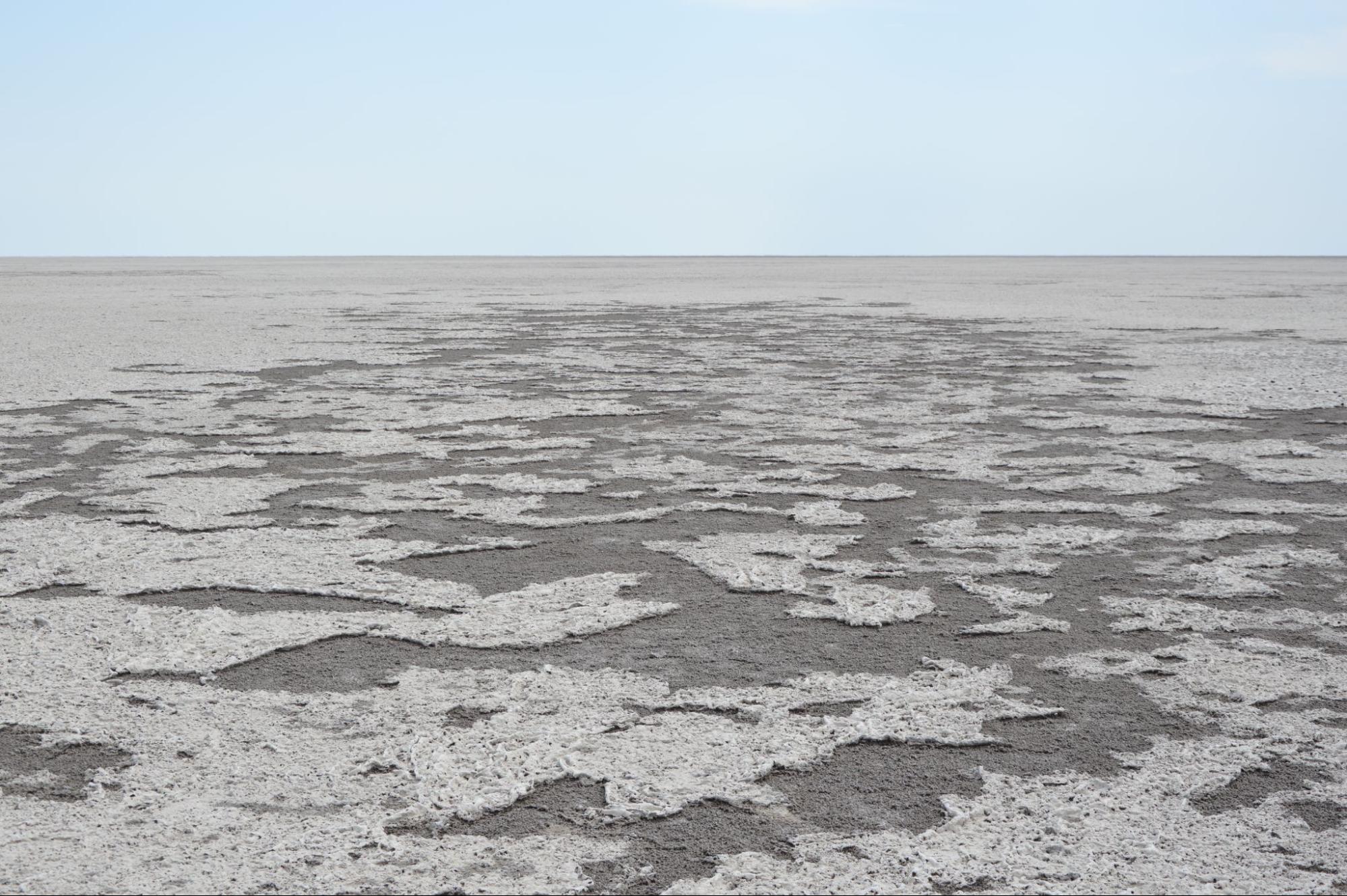
Figure 1: View of the Makgadikgadi Salt Pans. Credit: E Luzzi
In addition to the precious data that we collected, we indeed had a life-changing experience visiting one of the most remote places on Earth. From the absolute silence in the desert, to the calm and breath-taking landscapes in the savanna, for some moments we really felt like being on another planet. Among many adventures (and misadventures), we accessed this extraordinary place on Earth, where a lot has been studied but still leaving space for many mysteries: the Makgadikgadi salt pans (Fig. 1). These dry lands occupy a broad area in the savanna of Botswana, and are characterized by a mixture of clays and sulfates with recurrent morphologies related to desiccation processes, such as mud cracks (Fig. 2).
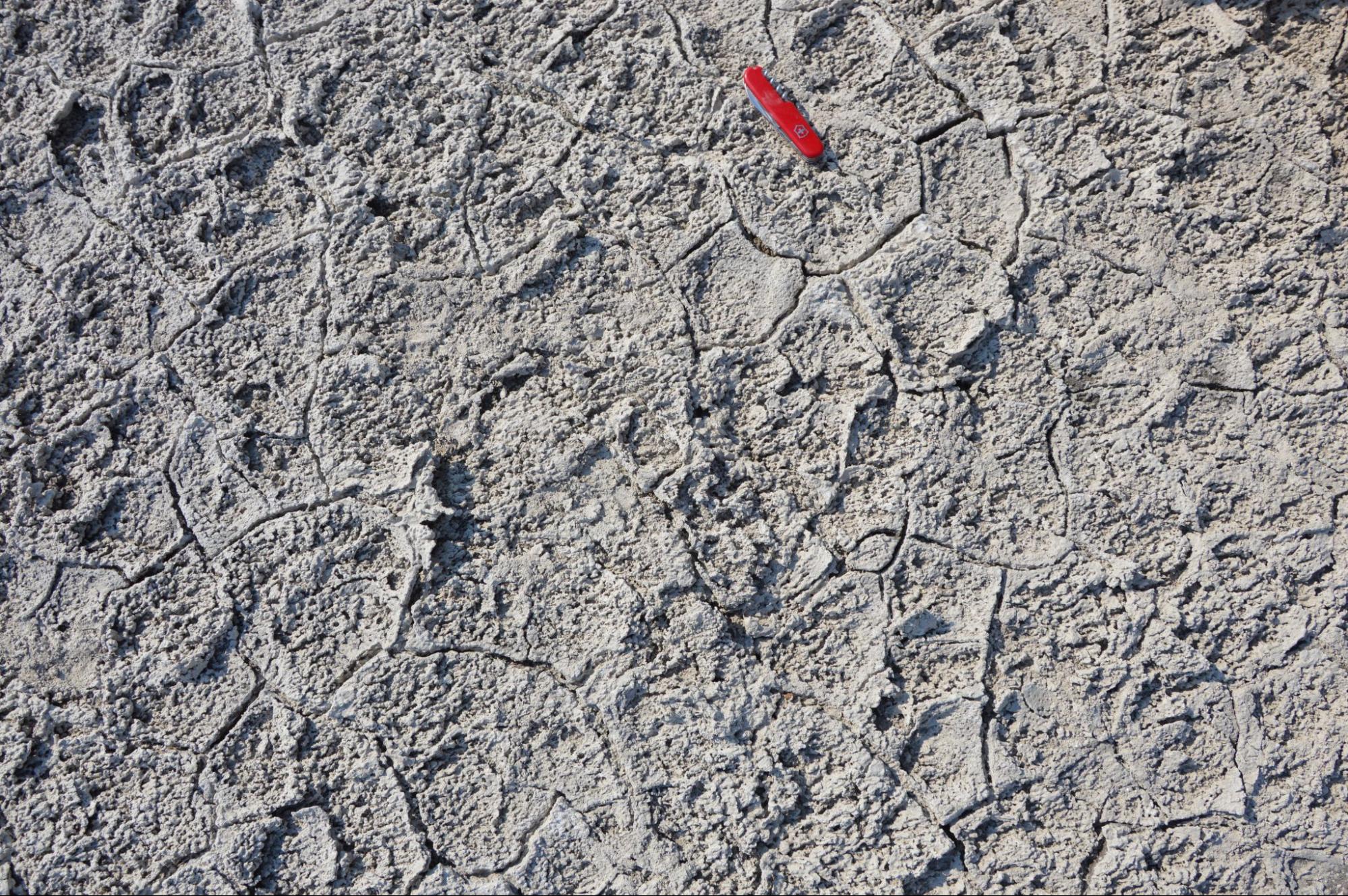
Mud cracks in the pan, formed by dessication processes typical of playa environments. Credit: E Luzzi
This area once hosted an ancient lake which, due to paucity of water, turned into a playa, namely a dry lake bed. Such dry environments are hypothesized to have occurred also on Mars, where also the same types of minerals have been detected.
Part of a line in the pan. The deployed cable followed the truck’s footprints that were guided by the GPS. Credit: E Luzzi.
By studying an analog field site that we can touch with our hands as it is located on Earth, we can get a variety of insights that may help us to better investigate the processes that shaped Mars into the planet we observe today.
In the region of Arabia Terra, on Mars, light-toned layered deposits often associated with mounds have been widely described in literature, and among other interpretations they were also attributed to playa-like environments. The aim of our work was to analyse the subsurface of the Makgadikgadi salt pans, looking for faults where water could have circulated and then contributed to the hydro-geological cycle that led to the deposition of such deposits.
We performed an Electrical Resistivity Tomography survey in different areas of the pans (Fig. 3).
This particular type of geophysical technique consists of placing a number of electrodes in the ground, carefully spacing them at an equal distance, and then applying a known current. Each material responds to the current in a different way, and many variables can influence the resistivity (e.g. porosity, water content, mineralogy, etc.). A preliminary version of the resulting images confirmed the occurrence of faults that will be better investigated after a robust post-processing of the data.
While we are still working on it, for now we can conclude that the survey has been successful and we look forward to linking our observations with the enigmatic deposits occurring in Arabia Terra, Mars.
Read more about Erica’s experiences on this thread on Twitter:
4) The team. Our group was composed by Gene Schmidt, first author of the future paper, Fulvio Franchi, prof at BIUST, Ame Thato Selepeng, prof at BIUST, Cabelo, an MSc student at BIUST, Rachel, driver at BIUST, and me. I thank them all for this extraordinary experience. 5/ pic.twitter.com/pabwcH8eC1
From 29 September – 6 October 2021, researchers Daniel Toledo and Victor Apestigue (Instituto Nacional de Técnica Aeroespacial (INTA), Spain) were funded by the Europlanet 2024 Research Infrastructure (RI) Transnational Access (TA) programme to visit the Makgadikgadi Salt Pans in Botsawana. The trip was led by Fulvio Franchi (Botswana International University of Science and Technology (BIUST)) who is responsible for the Botswana Planetary Field Analogue for Europlanet 2024 RI. Ignacio Arruego, Javier Martinez-Oter and Felipe Serrano (INTA) also participated in the field trip.In this guest post, Daniel Toledo reports on the field trip.
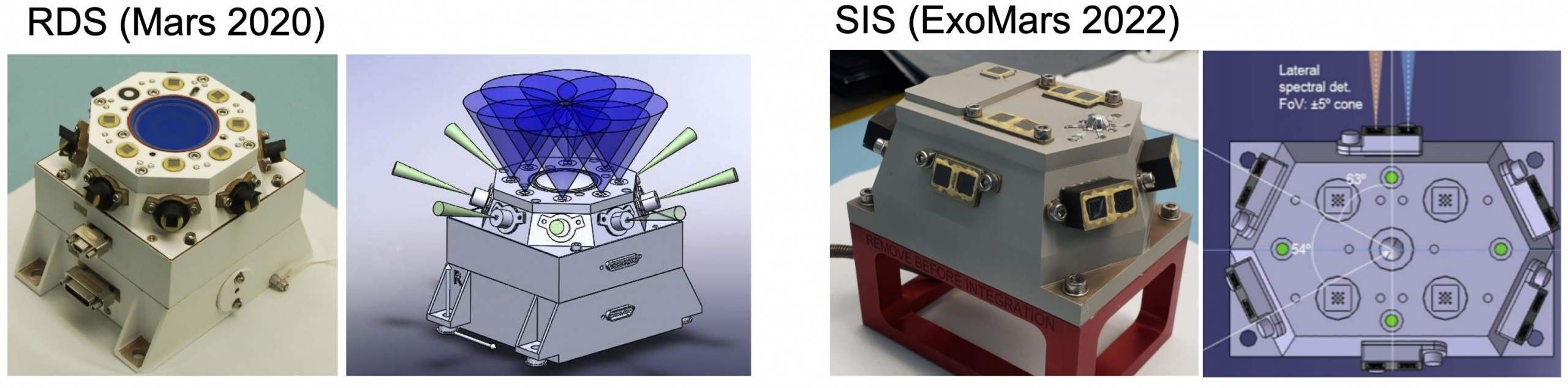
The main goal of the field campaign in the Makgadikgadi Salts Pans was to study how dust is lifted into the air. For our investigation, we used the spare units of the Radiation and Dust Sensor (RDS) from the NASA Mars 2020 mission and the Sun Irradiance Sensor (SIS) from the ExoMars 2022 mission (see Figure 1), which are designed to study dust carried in the atmosphere of Mars by measuring how sunlight is scattered by the dust particles.
In addition to giving information about the properties of airbourne dust, these instruments are also sensitive to the presence of dust devils – swirling columns of sand and dust that are a common feature of desert areas on Mars and on Earth. RDS and SIS can detect the changes over time in the sky brightness produced by a dust devil, and this offers a unique opportunity for monitoring and studying such events during the Mars 2020 and ExoMars 2022 missions. However, to be able to characterise and interpret dust devil observations on Mars, we first need to understand how dust devils affect SIS and RDS signals by thorough testing and evaluation of the instruments in Mars-like conditions on Earth.
Figure 1. (Left) RDS instrument: two sets of eight photodiodes. One set is pointed upward, with each photodiode covering a different wavelength range between 250-1000 nanometres. The other set is pointed sideways, 20° above the horizon, and they are spaced 45° degrees apart in azimuth to sample all directions at a single wavelength; a zenith-pointed camera (Skycam) with special optics is designed to measure column optical depth.(Right) SIS instrument: Five detectors pointed at zenith and with different spectral bands and Fields of View (FOVs); twelve lateral detectors (six in the ultraviolet range and six in the near infrared range) pointed sideways; a micro-spectrometer pointed directly upwards (at zenith) with a spectral resolution of 10 nanometres in the 340-780 nanometres range.
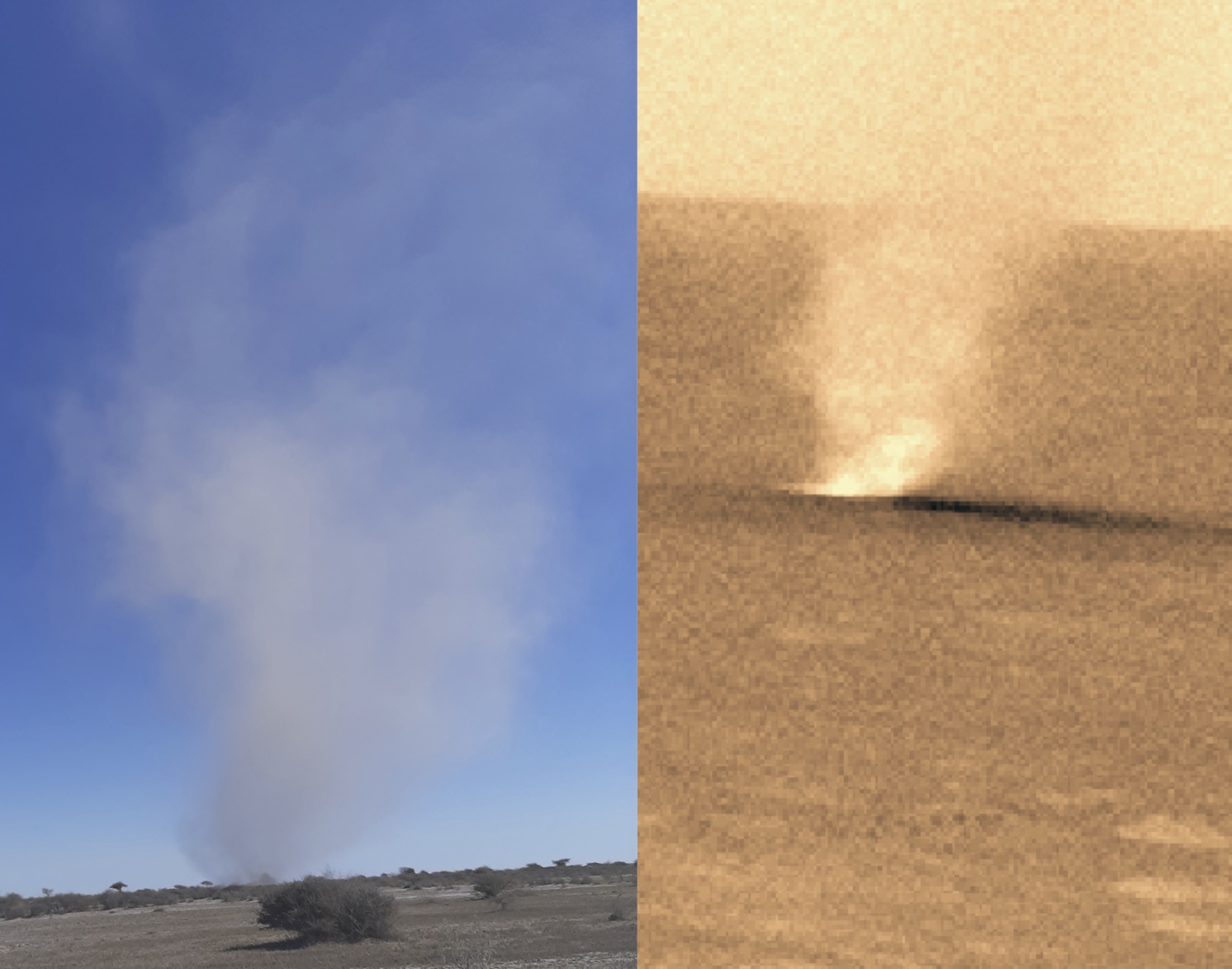
Figure 2. Dust devils observed in Makgadikgadi Salt Pans (left panel) and on Mars (right panel). A typical dust devil on Mars spans from hundreds of metres to thousands of metres in diameter, with a height one-eight times as large. Dust devils of Mars are thought to account for the ~50% of the total dust budget, and they represent continuous source of lifted dust, active even outside the dust storms season. For these reasons, they have been proposed as the main mechanism able to sustain the constantly-observed dust haze in the martian atmosphere.
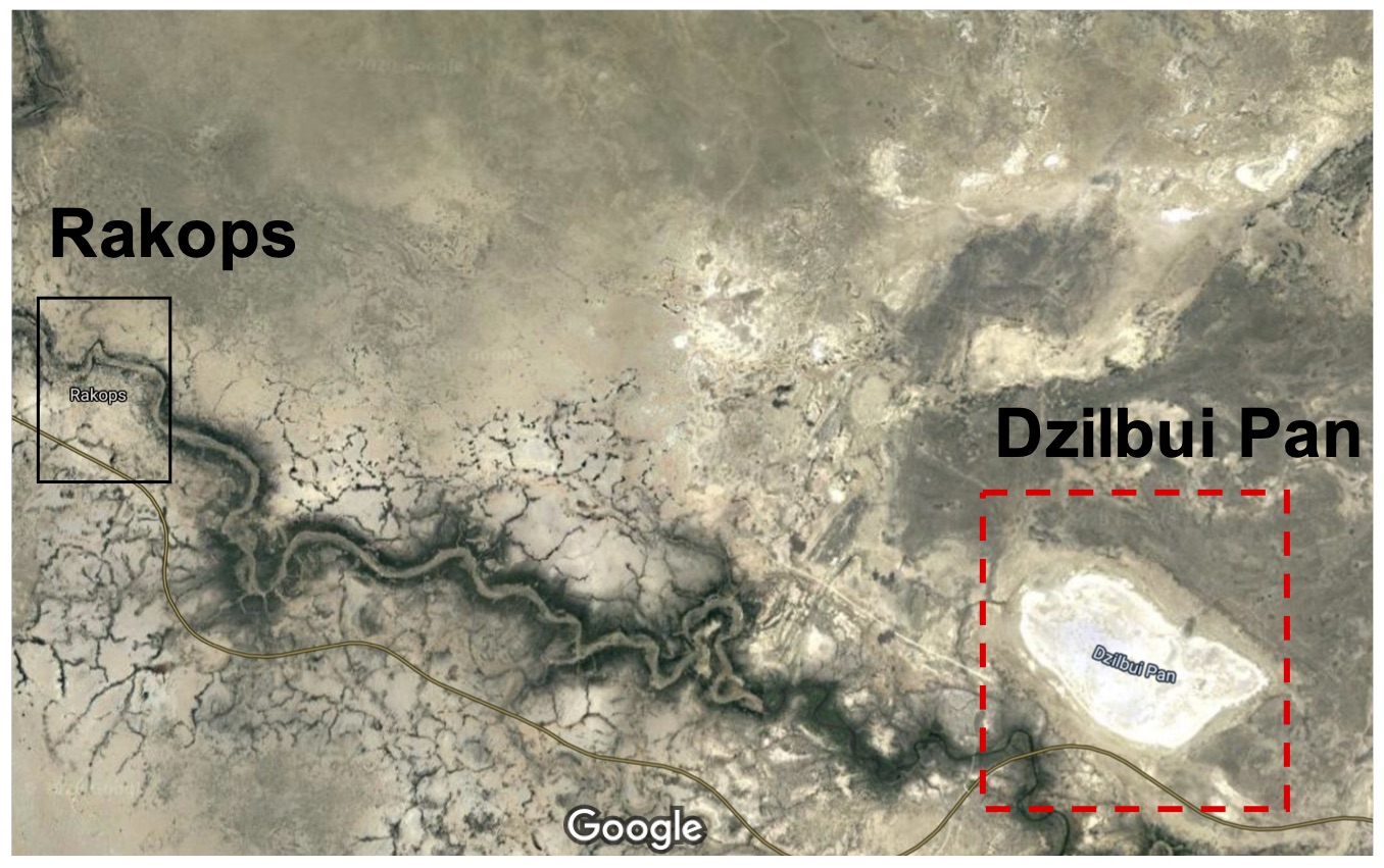
To achieve this goal, we planned a field campaign from 29 September to 6 October in the southern part of Makgadikgadi Salt Pans (see Figure 3), in the Pan near Mopipi town. This location is characterised by frequent dust devil events and conditions that promote the lifting of high levels of aerosols (dust and particles) into the atmosphere.
Each day of the campaign, we set up RDS and SIS at two different locations from sunrise to sunset, separated by about 25 m, along with:
Two cameras to record panoramic videos during the campaign period.
A Vaisala weather station to perform measurements of pressure, wind direction and intensity, temperature and relative humidity.
A ZEN radiometer to measure how much light was absorbed by the dust at different wavelengths.
The objective of having the two main instruments at two different locations was observe the dust lifting events from different perspectives.
During the campaign, we observed a large number of dust devils (many more than 10) and dust lifting events produced by wind gusts (over 10). For each dust lifting, we recorded the dust devil distance, the size, duration and direction. To do this, we marked out concentric circles with radii of 25, 50, 75, 100, 125 and 150 m on the ground. This information along with the videos made by the cameras, helped us to establish the amount of dust lifted by the dust devil as well as their distances from the instruments. All the data collected for each event was key to establish the RDS and SIS capabilities for dust lifting characterisation on Mars.
The first two days of the campaign were characterised by high dust-loading conditions and frequent formations of dust lifting events produced by dust devils or wind gusts. During these two days, each dust lifting event registered by the cameras was also detected by RDS and SIS, with signals showing a sharp peak at the time when the event passed within the sensors field of view. Preliminary analysis suggests that we can infer from RDS and SIS signals the difference between dust lifting events produced by dust devils and those produced by wind gusts – an important result for the observations on Mars.
Figure 3. Map indicating the location selected for carrying out the field campaign in the southern part of Makgadikgadi Salt Pans (red square) and the village Rakops (black square) where different lodges are available.
The third day of campaign had to be cancelled due to rain. This resulted in a lower dust-loading conditions in the following days, and thus the amount of dust lifted by vortices or wind gusts was smaller compared to the first two days.
Upon return to BIUST in Palapye on 6 October, we held a seminar for staff and students titled Atmospheric science on Mars: from Earth analogues to future planetary networks.
In summary, the campaign was a complete success. Our observations have demonstrated the capability of the RDS and SIS sensors to detect and characterise dust devils on Mars. The analysis of the signals along with the information acquired by the other instruments will allow us to quantitatively establish the sensors limit of detection. In addition, the rainy episode offered us the chance to study dust lifting events in different aerosol loading conditions.
Transnational Access Insight: Digging into the Story of Dust in Greenland
In this guest post, Ramona Schneider of Uppsala University describes her recent trip to Europlanet 2024 RI’s Kangerlussuaq Planetary Field Analogue Site in Greenland to understand the story of wind-blown particles of mineral dust and its role in arctic climate change since the end of the last Ice Age. Video by Petter Hällberg (edited by Luca Nardi) .
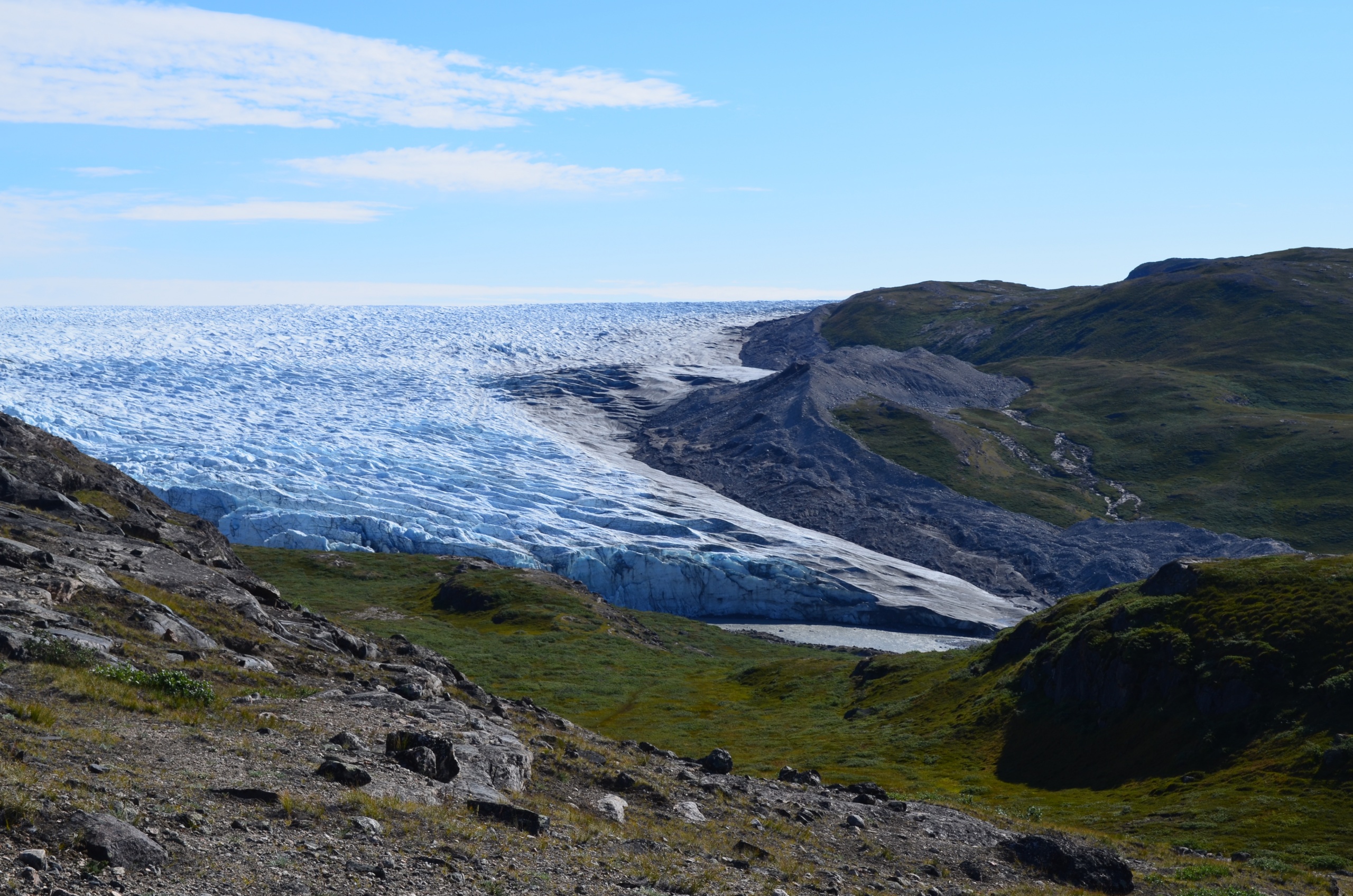
Our team of researchers from Uppsala University and Stockholm University visited the Kangerlussuaq Planetary Field Analogue site in Greenland through the Europlanet 2024 RI Transnational Access programme from 19-29 July 2021. Our project was to study deposits of Greenlandic loess – wind-blown dust that accumulates as sediment – in order to understand its role in the arctic climate change.
One of the sampling sites where the team conducted their research. Credit: Ramona Schneider
These sediment deposits are archives of past dust activity and allow us to investigate how dust and climate have developed during the current warm period, the Holocene, which began around 11,650 years ago.
Mineral dust in the atmosphere can have a big impact on climate change yet its role is not very well understood. This is critical to resolve, particularly in the Arctic, where the rate of current climate change is the fastest in recorded history.
Loess sampling. Credit: Ramona Schneider
Our work focused on the area between the Greenland Ice Sheet margin and Kangerlussuaq in western Greenland, which represents a range of different environmental conditions depending on distance from the ice sheet. We collected samples of loess deposits to test and compare the performance of different dating techniques, which allow us to date the timing of past dust deposition. Analysis of the chemical and physical properties of these sediments also help us to reconstruct climate changes in the past in Greenland.
We also sampled peat bogs – deposits of dead plant material – in order to understand how much dust has accumulated in these environments too.
Our investigations will enable us to attempt to reconstruct how much carbon was buried in these permafrost deposits in the past, and compare this result to the climate and dust records.
Peat sampling. Credit: Ramona Schneider
In doing so we hope to understand both regional climate history and dust dynamics close to the margin of the Greenland Ice Sheet, but also how dust and climate change may affect rates of carbon burial in permafrost more generally. This carbon burial in turn has an impact on atmospheric carbon dioxide levels and climate change.
All photos from the trip
The Transnational Access visit (20-EPN2-046) was supported by Europlanet 2024 Research Infrastrucutre and received funding from the European Union’s Horizon 2020 research and innovation programme under grant agreement No 871149.
Transnational Access Insight: Investigating Fingerprints of Life on the Greenland Ice Sheet
In this guest post, Laura Sánchez García of the Centro de Astrobiología (CAB, CSIC-INTA) describes her recent trip to Europlanet 2024 RI’s Kangerlussuaq Planetary Field Analogue Site in Greenland to investigate molecular and isotopic fingerprints of life on Greenland Ice Sheet (GrIS) cryo-ecosystems with astrobiological interest for icy worlds.
Glacial systems are interesting for studying habitability and the limits of life. They are extreme environments where microorganisms may survive prolonged exposure to sub-zero temperatures and background radiation over millions or billions of years. Glaciers and the surrounding icy “cryo” environments (permafrost, glacial lakes, or melting streams) can be used to study the development of microbial cryo-ecosystems and may have implications in the search for past or current life in icy worlds beyond the Earth.
In the Solar System, Jupiter’s moon Europa and Saturn’s moon Enceladus have been recognised as the icy worlds with highest likelihood to harbour life, largely because liquid water could be in contact with rocks. Both moons are believed to contain a global ocean of salty water under a rigid icy crust that would enable interaction between briny water and rocks, and allow the conditions for life to arise.
The permanent Greenland Ice Sheet (GrIS) is a potential analogue for such icy worlds, constituting an important historical record of microorganisms that can survive in extreme cold environments. Around the GrIS, different formations such as glacial lakes, permafrost, or further peat soils represent diverse stages of evolution of the GrIS and its thermal destabilisation.
We submitted a proposal to the second Transnational Access Call of Europlanet 2024 RI to visit the Kangerlussuaq Planetary Field Analogue Site in Greenland. In April 2021, we received the news that it had been successful, and our team’s visit took place from 19-29 July 2021.
Our project is an investigation of molecular and isotopic lipid biomarkers of microorganisms inhabiting different cryo-ecosystems at and around the GrIS. Through our results, we hope to obtain clues of a potential life development at an analogue site (ice sheet) of icy moons in our Solar System, and learn how ecosystems evolve (biological succession) when the ice cover retreats and gets exposed to the atmosphere (resulting in glacier-melting streams, bedrock-erosion sediments, lake sediments, glacial soils).
We searched for organics to study the molecular and isotopic composition of lipid biomarkers in environmental samples collected from different ecosystems in the Kangerlussuaq region on the west coast of Greenland, including:
The ice sheet cryo-environment,
Nearby glacier-influenced ecosystems in and around glacial lakes
Longer time-exposed and further-developed lake and soil ecosystems.
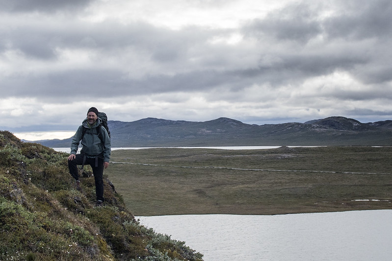
Ice sheet cryo-environment
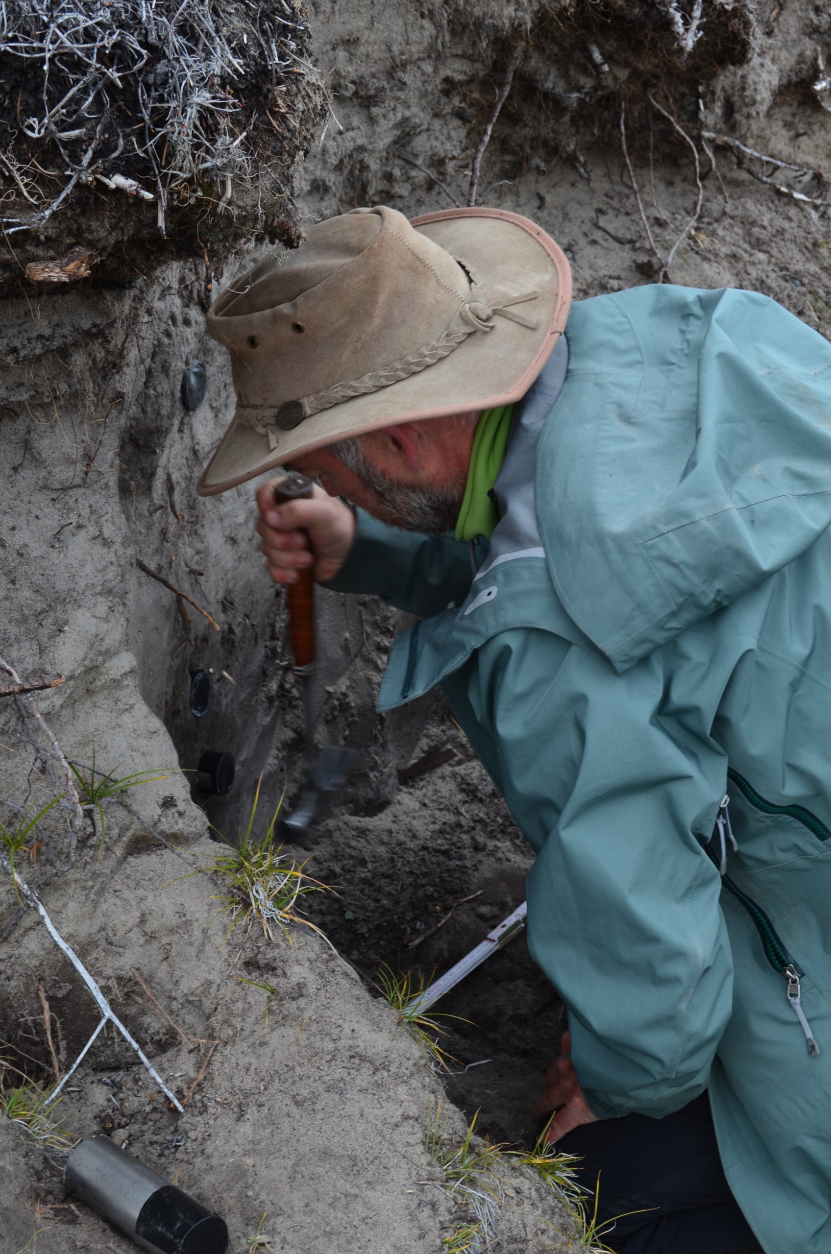
For the ice sheet study,we chose an ice sheet region in the Issunguata Sermia glacier system. There, we spotted four sites for sampling ice cores:
One near the glacier front, where ice is relatively older and carries plenty of dark, grey, fine material from the bedrock erosion during the glacier advance.
Two a bit further northeast in the ice sheet, where the ice is relatively younger and looked like slightly cleaner (i.e. whiter).
One further north, in the highest height, where the ice looked cleanest (i.e. whitest).
In the four sites, ice cores were retrieved down to 50-80 cm depth with a manual ice driller and, when the driller didn’t go deep enough, we dug a surface of about 35×35 cm2 with a geologist’s hammer to collect as much ice as possible down to the deepest depth reached by the drill.
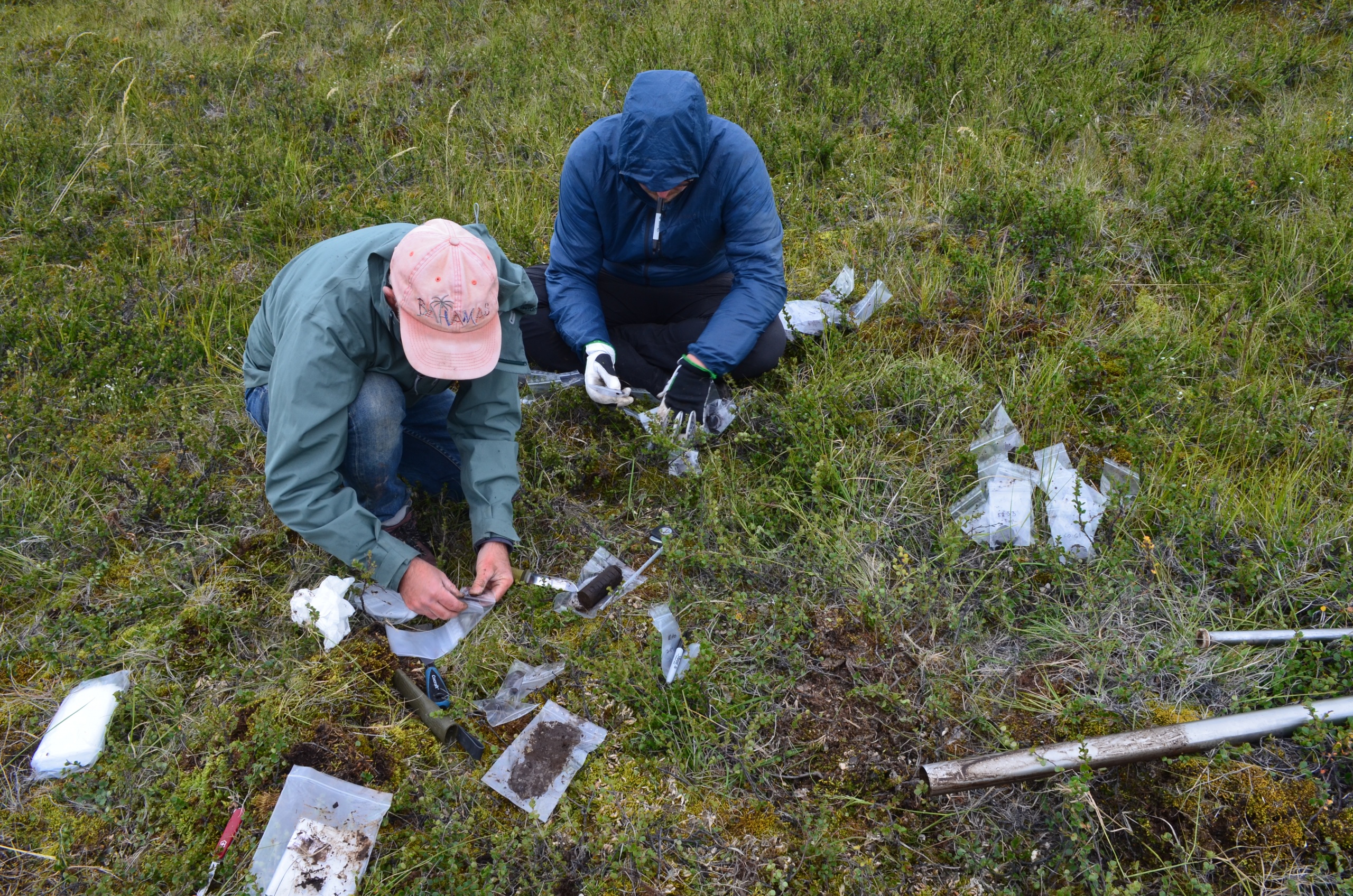
Together with the ice drills, we also collected additional samples from:
Melt water from a glacial stream flowing through the ice sheet.
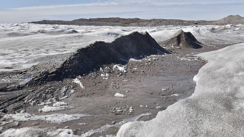
Dark grey sand-sized sediments (with pebbles and small stones) from hill of deposits on the ice sheet coming from the erosion of the bedrock during the glacier advance.
Dark blackish, fine sediments outcropping from an ice wedge, also coming from glacial erosion of the bedrock.
The four ice drills were melted and, together with the melt water sample, were filtrated through 0.7 μm pore-size glass fibre filters, to recover the particulate matter and look for total organic carbon and lipid biomarkers.
2) Nearby glacier-influenced ecosystems in and around glacial lakes
For the study of the glacial lakes study, we chose two different systems:
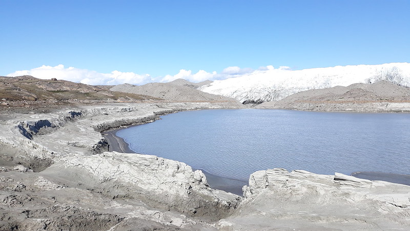
A glacial lake (GL1) about 200 m apart from an edge of the glacier Issunguata Sermia.
In this lake, we sampled a surface sediment from near the shore, together with sediments from an exposed “terrace” near the shore, where material at ground level represented the oldest and that at top of the terrace the youngest. The terrace was assumed to be composed of sediments accumulated in the past when the lake had a higher water level compared to today.
A multiple-lake system next to an edge of the glacier Issunguata Sermia.
The lake system is composed of four interconnected glacial lakes, where the first lake (GL2; closest to the glacier edge) receives water from the melting glacier and feeds the second lake (GL3), which in turns feeds the third (GL4), and this the fourth (GL5).
Here, we collected water (for chemical analysis) and surface sediments (for lipid biomarkers analysis) from the four lakes, and a 25 cm-deep sediment core only from the fourth lake (i.e. furthest from the glacier edge).
3) Longer time-exposed and further developed lacustrine and soil ecosystem
We aimed to assess the organic-composition differences between glacial and non-glacial lakes, so we also sampled a number of non-glacial lakes fed by meteoric (rain and surface runoff) water:
A small lake (L6): a lake about 1 km long and 0.5 km wide that is about 3 km apart from Issunguata Sermia.
Long Lake (L7): a relatively larger lake about 10 km long and 1.5 km wide that is about 11 km apart from the same glacier.
Salt Lake (SL): a lake about 600 m long and 500 m wide furthest from the glacier, and about 3-4 km apart from Kangerlussuaq.
In the three lakes, we sampled water (for chemistry analysis) and surface sediments near the shore. Then, for the small lake (L6) and Salt Lake (SL), we collected a sediment core of 14 and 34 cm depth, respectively. At the Salt Lake basin, we also collected samples from a terrace in the shore, corresponding to past sediment/peat material piling up at the lake shore.
4) Soil development on glacier retreatment
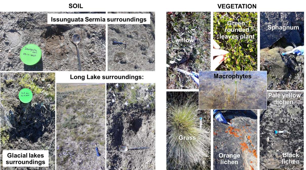
Finally, we wanted to learn about the soil development upon glacier retreatment, so we collected soil samples from a transect that included:
A young soil (poorly-vegetated so far) from recently exposed ground near the present margin of the Issunguata Sermia glacier.
A relatively older soil (more developed and vegetated) from the basin around the last lake of the four interconnected glacial-lakes system (i.e. GL5).
An even older soil (the most developed) from the Long Lake surroundings.
In order to get a glimpse of the fresh isotopic signatures from the vegetation contributing to the soil lipidic fingerprint, we also collected samples from the most representative vegetal specimens found in the studied area: sphagnum; grass; rounded-leave creeping plant with white flowers; orange, black, and pale-yellow lichens; and submerged and emergent macrophytes (from GL1). Most vegetal samples were collected from the surroundings of glacial lakes GL1 and GL4.
Following our return from Greenland, we are now starting on the analysis of samples and aim to publish our findings in a paper.
All photos from the trip
The BioGreen Transnational Access visit was supported by Europlanet 2024 Research Infrastrucutre and received funding from the European Union’s Horizon 2020 research and innovation programme under grant agreement No 871149.
Three missions are converging on Mars this week to study the Red Planet from orbit and explore its surface. With the United States, United Arab Emirates and China all sending missions to Mars, we look at how Europe’s planetary research community is contributing to Mars exploration in 2021 and at its plans for the next few years.
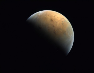
First image of Mars from Hope. Credit: MBRSC / UAE Space Agency / CU-LASP/EMM-EXI
It’s a busy time at Mars. The United Arab Emirates (UAE) Space Agency’s first mission to Mars, Hope, performed a successful manoeuvre to enter a capture orbit on 9 February 2021. Once in its final science orbit, Hope will study dynamics in the martian atmosphere on a global scale, giving a more complete understanding of interactions between the atmospheric layers, and answering questions about how oxygen and hydrogen escape into space.
On 10 February, the Chinese Tianwen-1 (‘questioning the heavens’) mission, joined Hope in orbit around Mars. Tianwen-1 will analyse the chemical composition of rock and dust and search for pockets of ice and liquid water and organics. Following three or four months of study of the surface, and a detailed survey of the proposed landing site, Tianwen-1 will release a lander and rover. If all goes to plan, the rover will explore Utopia Planitia, a flat plain within a large impact basin in the northern hemisphere of Mars. The region is covered by extensive sedimentary materials, with features that indicate that ice or water are present.
Tianwen-1 carries 13 instruments, two of which have a small European involvement: The Institut de Recherche en Astrophysique et Planétologie (IRAP), France, has contributed to the calibration of the LIBS spectrometer on the Tianwen-1 rover’s Mars Surface Composition Detector. The Space Research Institute (IWF-Graz) has contributed to the calibration of the magnetometer on the main satellite.
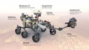
Completing the trio, NASA’s Mars 2020 mission will arrive at Mars on 18 February. Mars 2020 mission will look for signs that there were habitable conditions on Mars in its early geological history, and seek evidence of past microbial life. The Perseverance rover and its helicopter partner, Ingenuity, will explore the terrain of Jezero Crater on Mars, which contains the remains of an ancient, partially-eroded river-delta. Jezero’s rocks date back to around the time that we think that life first arose on Earth. Perseverance will characterise its geological setting and collect a few core samples of the most promising rocks and soils. These will be set aside in a cache for collection and return to Earth by missions later this decade.
The instruments carried by NASA’s Perseverance rover. Credit: NASA
Of the seven primary scientific instruments carried by the Perseverance rover, three include significant European contributions: the weather station MEDA (provided by Spain with contributions from Finland), the remote-sensing laser micro-imaging SuperCam (provided by France/Spain) and the ground-penetrating radar RIMFAX (provided by Norway).
Although not part of the flotilla arriving at Mars this year, the ESA/Roscosmos ExoMars mission will set off in the late summer or autumn of 2022 and land in the spring of 2023. The ExoMars Rosalind Franklin Rover is equipped with a drill that will sample the subsurface in places that are most likely to have habitable conditions preserved in ancient rocks.
The first ExoMars mission, the Trace Gas Orbiter (TGO), which arrived at Mars in 2016, carries a suite of instruments to study traces of methane and other atmospheric gases. TGO will also act as a data relay for Perseverance (a service it already provides for the Curiosity and Insight missions) and, later, for the ExoMars Rosalind Franklin rover. ESA’s highly successful first mission to the Red Planet, Mars Express, which has been in orbit since 2003 and is still making important contributions to studies of the martian surface, atmosphere and ionosphere, is also playing a part in monitoring local conditions at Jezero Crater.
Europlanet 2024 RI’s TA2 laboratory facilities also support the exploration and the search for biomarkers on Mars. The Centre for Microbial Life Detection in Graz provides expertise in extracting and sequencing DNA from microbial samples collected in extreme environments on Earth, as well as quantifying bacteria, archaea and fungi, and cultivating specialist microbes (e.g. anaerobes) that survive under these conditions.
Simulations and calibration measurements carried out at the spectroscopy laboratories at DLR and Grenoble will be used to interpret the spectroscopic data obtained by the Tianwen-1 orbiter. The Aarhus Mars Wind Tunnel and Open University’s Mars Chamber also include facilities capable of simulating Martian atmospheric conditions.
Early life on Mars may have been destroyed after the loss of its atmosphere, which provided a shield against harmful ultraviolet radiation. This means that finding evidence for past life may be through indirect means, for example by identifying chemical changes to minerals or specific reactions that are only induced by life. Samples taken from terrestrial analogues and analysed in laboratories can help interpret data from in-situ missions and refine techniques. However, within the limitations of what it is possible to launch into space, it is likely to be difficult for robotic missions operating on the surface of Mars to provide conclusive evidence of whether life has ever existed there.
Rio Tinto in Spain is a terrestrial analogues of Mars. Image credit: F Gomez.
NASA and ESA are collaborating on a Mars Sample Return campaign involving three missions stages: a sample collection rover (Perseverance); a Mars lander carrying a small ESA-led rover to ‘fetch’ and load the samples into NASA’s ‘Mars Ascent Vehicle’ that will launch them into Mars orbit; and a Mars orbiter to capture the sample container (led by NASA) and fly it the rest of the way to Earth (led by ESA).
The samples collected by Perseverance will contain martian rocks, soil, dust and atmosphere and are expected to be about 15 g of material each and be roughly the size of a stick of chalk. Bringing carefully selected rocks from Mars back to Earth for detailed study will enable much more complex and complete studies using state-of-the-art lab equipment. This will give a better quantitative understanding of whether the returned samples formed in environments where life could have existed and whether they may contain biosignatures
Europlanet 2024 RI Joint Research Activities (JRAs) involving the Natural History Museum, the Vrije Universiteit Amsterdam, ETH Zurich and the Open University are supporting the development of techniques for non-destructive or minimally invasive characterisation and analysis of precious returned samples.
Europlanet 2024 RI is also offering virtual services to support observations and analysis.
A successful landing depends heavily on site selection and characterisation, tasks that are strongly tied to geologic mapping. Europlanet 2024 RI’s new geological mapping service, GMAP, fosters and supports mapping of the geology of all suitable Solar System bodies. In the case of the Moon and Mars this will include specific geologic and geomorphic mapping of past, proposed and future landing sites.
The virtual observatory for Solar System data, VESPA, hosts several data services from past Mars missions, including Mars-Express (OMEGA, HRSC, SPICAM), CRISM data from Mars Reconnaissance Orbiter, a Martian craters database, simulated atmospheric profiles (derived from the Mars Climate Database), Hubble Space Telescope observations, significant data about the magnetosphere, as well as access to the Planetary Science Archive (PSA).
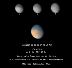
Mars image from PVOL database. Image taken on 8 February 2021 by Mike Hood in Kathleen, Georgia, USA. Credit: M Hood.
The Planetary Virtual Observatory and Laboratory (PVOL) data service includes nearly 4000 observations of Mars contributed by amateur astronomers, which are used for research purposes by several professional and amateur teams.
Finally, Europlanet is developing educational resources that draw on missions and the latest research in laboratories and field sites to bring Mars into classrooms across Europe. Those students inspired by the missions in 2021 may one day have the opportunity to handle and analyse the samples collected and brought back from Mars by future missions.
Europlanet 2024 RI is one year old this week. Despite the pandemic, there has been a great deal of activity and progress over the past twelve months. The project is on track in its work to support the planetary community and provide state-of-the-art access to services and facilities for research in planetary science and related fields.
A core part of the work of a research infrastructure is to provide free, cross-border access for researchers to planetary analogue field sites, simulation and analysis facilities. Two calls for applications for Transnational Access (TA) were issued in Year 1 of the project and, despite Covid-19 restrictions, the first visits have started to take place.
The suite of field sites and laboratories offered by Europlanet 2024 RI now numbers over 40 and has been expanded in Call 2 to include 11 laboratories in South Korea. Call 3 will include further facilities in China and Korea, plus field sites in the Argentinian Andes.
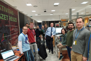
TA visit to Atomki-ICA. Credit: D Mifsud
Call 1, which closed on 5 May 2020, received 80 applications, of which 41 were funded. Despite the ongoing travel restrictions due to Covid-19, applications for Call 2, which closed on 6 January 2021, rose by 25% to a total of 101 submissions. The successful Call 2 applications will be announced by the end of March.To date, three TA visits have taken place, including a virtual and an in-person visit to the Atomki Ice Chamber for Astrophysics/Astrochemistry (ICA) facility in Hungary and a virtual visit to Cold Surfaces Spectroscopy laboratory at IPAG in France. Some of the TA applicants have shared their experiences of submitting a successful TA proposal in a recorded webinar.
TA Development
Six of the TA facilities are being upgraded as part of the Europlanet 2024 RI project and the first of these projects has been completed.
The Europlanet ICA support team. Credit: Atomki
In early 2020, an existing ultra-high vacuum chamber (provided by Queen’s University Belfast) was shipped to Debrecen in Hungary and installed at the beamline of Atomki’s 2MV Tandetron accelerator. The chamber has been upgraded with ultraviolet/visible and mass spectroscopy extensions that will optimise it for studying the effects of ion irradiation on a variety of different ice surface analogues. These upgrades will support research to improve our understanding of the physical and chemical processes in the Solar System. The augmented facility was operational in time to be included in the first TA call in May 2020, and the first two visits have already taken place. Find out more about the upgrades to the facility.
Virtual Access
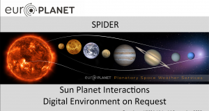
SPIDER
SPIDER (Sun-Planet Interactions Digital Environment on Request) is providing access to six services for modelling planetary environments and solar wind interactions through a run on request infrastructure and associated databases. The SPIDER Virtual Access (VA) activity extends the twelve planetary space weather services developed through the previous Europlanet 2020 RI project (2015-2019).
In the first year of Europlanet 2024 RI, the first two SPIDER services have been prototyped and made operational:
A Mercury exosphere run on request service
A planetary plasma instrument background counts database and service.
SPIDER services have also been utilised during the Bepicolombo Venus flyby in October 2020 and will be used again for the first Mercury flyby in 2021.
Simulations of Mercury’s magnetosphere using the operational SPIDER service have been performed, analysed and accepted for peer-reviewed publication in the journal Planetary and Space Science (Cross-comparison of global simulation models applied to Mercury’s dayside magnetosphere, Aizawa et al, 27 January 2021). The SPIDER project and results were presented in a session on planetary space weather at the Europlanet Science Congress (EPSC) 2020.
VESPA
VESPA (Virtual European Solar and Planetary Access) is a network of interoperable data services covering all fields of Solar System Sciences. It is a mature project, developed within previous Europlanet projects and already connects 55 services.
During Year 1 of the Europlanet 2024 RI project, planned workshops to integrate new data services into VESPA have been put on hold due to the pandemic. However, additional services have been published from legacy Horizon 2020 programmes, including Small Bodies Near and Far (SBNAF), and large infrastructures, such as eCallisto, a network of space weather radio observatories.
The Planetary Virtual Observatory and Laboratory (PVOL) service for amateur images has grown by 15% this year and now exceeds 50,000 entries.
The impact of VESPA has been significantly extended through collaborations with data infrastructures and international consortia. Representing VESPA, Europlanet Society has joined the International Planetary Data Alliance (IPDA) alongside national and international space agencies. The VESPA access protocol, EPN-TAP, is in a final validation stage by the IPDA and the International Virtual Observatory Alliance (IVOA).
VESPA Development
During the first year of the project, VESPA has set up various communication tools and started the study of new infrastructure elements.
Key milestones include:
The run-on-demand platform, OPUS, developed through the H2020 ESCAPE programme, has now been installed for VESPA. ESA is currently testing applications for the JUICE mission with Callisto flyby sequences.
Test data services are being installed on the European Open Science Cloud (EOSC) through the VESPA-Cloud pilot activity, with support from eduTEAMS/GÉANT and EGI to identify a standard installation procedure on the cloud.
New versions of existing display and analysis tools have been released with extended support for VESPA data services and EPN-TAP.
The SSHADE spectroscopy infrastructure has been enlarged to support multi-angular data and band lists.
GMAP
GMAP (Geologic MApping of Planetary bodies) integrates partners and outputs from two projects previously funded by the EU through Horizon 2020 (UPWARDS and PLANMAP) to deliver tools and services for geological mapping of any Solar System body. The infrastructure created through GMAP will support future European missions in developing orbital acquisition strategies, rover deployment and traverses, and human exploration programmes.
In Year 1 of the Europlanet 2024 RI project, information and data access components for GMAP service provision have been set up, for both internal and external user communities, and new collaborations have been established around the world.
GMAP Development (Joint Research Activities)
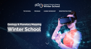
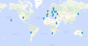
The first step in building a community of GMAP VA mappers has been through a Planetary Mapping Winter School, co-organised by GMAP and PLANMAP. This Winter School was over-subscribed, and the registration was closed two weeks early after 200 participants signed up from around the world. The Winter School took place from 1-5 February 2021, with 130 participating in the live hands-on programme and a further 70 following activities via the OpenPlanetary portal. The programme has included lectures and practical experience in creating planetary geological maps, with instructors including high-profile experts from the planetary mapping community across Europe. Promotion of the event was supported through the Europlanet Society and the Europlanet Early Career (EPEC) network. It is anticipated that many of the participants will form part of the community of planetary geological mappers that will support the development of GMAP.
The Winter School has also put in place an overall architecture and dedicated web-domain for future training schools, which will serve as core events to publicise GMAP activities during the years to come. The school will also be a source of recorded material for the future promotion of GMAP activities.
GMAP development activities have also resulted in Chinese partners successfully obtaining funding through the Chinese Ministry of Science and Technology (MOST). The funding of 3,160,000 RMB (~400,000 Euros) has been awarded to the ‘Key Technologies and Demonstration of Standardised Planetary Geologic Mapping’ project led by Prof Zhizhong Kang of the China University of Geosciences, Beijing (CUGB), which runs from 1st December 2020 until 30th November 2023.
Machine Learning Solutions for Data Analysis and Exploitation in Planetary Sciences
The Machine Learning activity in Europlanet 2024 RI aims to foster wider use of machine learning technologies in planetary research, and to develop open-source machine learning tools for specific science cases.
At the end of the first year of Europlanet 2024 RI, the Machine Learning activity is progressing work on four science cases. These include:
The automatic identification and classification of interplanetary coronal mass ejections in in-situ solar wind data, with the aim of improving early detection and ultimately forecasting.
The automatic identification of magnetopause/bow shock crossings on Mercury through MESSENGER data, with the aim of improving our understanding of Mercury’s magnetosphere and its dynamics.
The development of a generalised machine learning pipeline for the localisation and characterisation of specific geomorphological features (mounds) that are present on the surface of Mars (science case in collaboration with GMAP).
The application of a deep learning object detection algorithm to detect pit craters on the surface of Mars from images obtained by the HiRISE instrument onboard the Mars Reconnaissance Orbiter (science case in collaboration with GMAP).
The first three science cases above will be completed in February and March 2021.
A Europlanet Machine Learning Portal has been launched and serves as a public access point for the services. A public GitHub has also been set up, where codes and scripts are available for the scientific community. The first results of the science cases were presented at EPSC2020 as well as at the European Space Weather Week.
Networking Activities (NA)
Community Support, Dissemination and Engagement with Stakeholders (NA1)
The Community Support, Dissemination and Engagement with Stakeholders Networking Activity aims to foster co-operation and to extend the user base of Europlanet 2024 RI’s facilities and services. Activities are focused around specific audiences (industry, under-represented states, early careers, the media, policy-makers and educators) and goals (widening participation, global collaboration, expert exchange and outreach).
Highlights from networking activities in Year 1 of Europlanet 2024 RI include:
Holding EPSC2020 as a successful virtual meeting with 1168 participants from 67 countries (the largest stand-alone EPSC to date).
A high-level Industry and Policy session at EPSC2020 that included participation by three Members of the European Parliament (MEPs), a representative of the Commission, and representatives of academia and industry.
A training workshop on how to write a successful proposal for the Europlanet 2024 RI Transnational Access (TA) programme
The delivery of the Global Collaboration and Integration Development Strategy 2020-2024.
The launch of a pilot TA programme for European and Korean researchers to have reciprocal access each other’s facilities.
The launch of the Europlanet Early Careers Training and Education Portal and a pilot Mentoring Programme involving 10 pairs of mentors and mentees.
The launch of an internship programme for early career researchers to develop social media and communications skills.
The award of funding to four high-quality outreach projects, following the highest number of applications to date for the Europlanet Outreach Funding Scheme.
Provision of virtual training to outreach and education providers
Completion of seven educational resources related to Mars and Europlanet 2024 RI planetary field analogue sites.
Distribution of 11 Planets in a Room (PIAR) spherical projector kits to outreach providers around Europe.
The establishment of a not-for-profit German enterprise company with charitable objectives, FTP-Europlanet gUG, as a first step in ensuring long-term sustainability of Europlanet education and outreach activities.
Coordination of Ground-based Observations (NA2)
The Coordination of Ground-based ObservationsNetworking Activity (NA2) is a network of small telescope facilities and supporting the integration of amateur astronomers into planetary sciences.
Facilities in the NA2 Telescope Network.
The Europlanet Telescope Network, launched in June 2020, currently links 16 facilities located around the globe that range from 0.25 – 2m in diameter. At present, 14 out of 16 of the observatories can provide remote observations, enabling the network to operate despite Covid-19 travel restrictions.
To date, seven applications have been received, with four projects being awarded funding and three projects under consideration. The first observations started in January 2021. All four successfully-funded projects to date are led by female scientists from an under-represented state and cover the following topics:
Reducing the selection effects in asteroid spins, shapes, and thermal parameters (application for seven nights at Moletai Astronomical Observatory, Lithuania). Project led by A Marciniak, Poland.
Characterisation of V-type asteroids outside the dynamical Vesta family (application for eight nights at Chuguev Observatory, Ukraine). Project led by D Oszkiewicz, Poland.
Precise asteroid volumes from Gaia and ground-based observations I (application for six nights at Tartu Observatory, Estonia). Project led by M Polinska, Poland.
Precise asteroid volumes from Gaia and ground-based observations II (application for five nights at Observatorio del Teide, Spain). Project led by M Polinska, Poland.
NA2 is also harnessing the amateur community through observational campaigns on planetary topics. In Year 1 of Europlanet 2024 RI, six observational alerts were issued through PVOL database, and these were followed by over 200 active observers. The observations related to two of the alerts (March 31: Storm Activity on Saturn’s North Polar Region and May 31: Jupiter Storm in the South Temperate Belt) have contributed to two research papers that are being submitted for publication by researchers at UPV/EHU.
Management
Project kick-off meeting. Credit: J Dempster
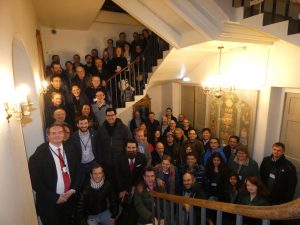
With over 50 beneficiaries, Europlanet 2024 RI is one of the most complex distributed research infrastructures funded by the European Commission to date. Over 60 members of the Europlanet 2024 RI Consortium gathered in Windsor on 27th and 28th February for the formal launch of the project, just before full lockdowns were implemented in most countries around the world.
Over Year 1 of the project, the Management Team has administered the project and provided management and financial oversight, ensuring that progress is on track for project deliverables, milestones and budgets. The Europlanet 2024 RI structures and committees (including the Steering Committee, the Project Management Committee and the Project Advisory Board) have been set up and supported in their roles, and reporting procedures and record management systems have been devised and implemented in accordance with the project Grant Agreement and European Union standards.
The Management Team has communicated news and updates to project beneficiaries and the wider community, and has implemented actions, including the distribution of the grant amongst the beneficiaries. Outcomes of a successful Council meeting, held virtually in October, culminated in the submission of a Grant Amendment to the European Commission to adapt to changes in project objectives in light of the pandemic, as well as adding new beneficiaries and expanding the suite of TA facilities.
Registration for virtual workshop: How to apply successfully for a TA call
Date and time: 3rd December, 10-13 CET
A virtual workshop will be organised on 3 December, from 10:00 to 13:00 CET, to help applicants to submit high quality proposals for the Europlanet 2024 RI Transnational Access (TA). Participants will have the chance to talk to the TA programme organisers, learn about the full procedure, be given some useful tips and hear about successful projects.
Participation is free. To register, fill in the form below:
If you have any questions, please contact Melinda Dósa: dosa.melinda@wigner.hu
Europlanet 2024 RI has received funding from the European Union's Horizon 2020 research and innovation programme under grant agreement No 871149.
Europlanet AISBL (Association Internationale Sans But Lucratif - 0800.634.634) is hosted by the Department of Planetary Atmospheres of the Royal Belgian Institute for Space Aeronomy (BIRA-IASB), Avenue Circulaire 3, B-1180 Brussels, Belgium.