20-EPN2-117: Exploring Mars’s Rootless Cones Based on the Geomorphometry of Icelandic Analogues

20-EPN2-117: To the Root of a Problem – Exploring Mars’s Rootless Cones Based on the Geomorphometry of Icelandic Analogues

Sebastiaan de Vet (TU Delft, Netherlands) and Lonneke Roelofs (Utrecht University, Netherlands) to TA1.1 – Iceland Field Sites, MATIS
Dates of visit: 04-12 July 2022

Rootless cones are created by steam explosions when lava flows interact with local water sources. Consequently, these landscape features offer a unique palaeo-environmental insight into the conditions at the time of the eruption. Rootless cones have also been identified on planet Mars. The aim of this project was to identify geomorphological and morphometric characteristics of Icelandic rootless cones and use these insights to infer the formation conditions and palaeo-environmental significance of rootless cones on the planet Mars. While features on Mars can only be studied remotely through satellite data, this project leverages the accessibility of lcelandic analogues to study their morphologies and properties in fine details. The rootless cone groups in the Younger Laxa Lava are uniquely and specifically suited for this purpose; they offer a morphological variety along various gradients of lava-water interactions.

During the field project the team intended to map representative rootless cones in the Younger Laxa Lava in high-resolution during a drone-assisted photogrammetric survey and analyse high-resolution Digital Terrain Models to quantitatively compare rootless cones on lceland and Mars. However, logistical issues arising in the aviation industry during Summer 2022 resulted in a temporary loss of fieldwork gear. The project was thus refocussed to carry out a field campaign to collect representative pilot-dataset to meet parts of the initial goals and prepare for a future follow-up campaign.

Banner image: A rootless cone at Myvatn Lake, Iceland. Credit: Hansueli Krapf/CC BY-SA 3.0


22-EPN3-005: Spatial Relationship Between Biosignatures and Their Geologic Context by Large-scale Geoscientific Mapping at Rio Tinto, Spain

22-EPN3-005: Spatial Relationship Between Biosignatures and Their Geologic Context by Large-scale Geoscientific Mapping at Rio Tinto, Spain

Visit by Alessandro Frigeri (INAF, Italy) and Giacomo Panza (intern at INAF, University of Bologna, Italy) to TA1.2 Rio Tinto (Spain).
Dates of visit: 07-11 November 2023

Report Summary: Since the early 2000’s, Rio Tinto has been a critical witness plate for the investigation of extremophiles and it is recognized to be a mineralogical and geochemical analog of Mars (Amils et al., 2014). The Mars Analog Rio Tinto Experiment (MARTE), in particular, demonstrated that the Rio Tinto biosphere extends at least 900 meters below the land surface with a high potential of anaerobic microorganisms to be present (Stoker et al., 2008). Host rocks, however, are exposed at the surface in sediments and rocks of the Rio Tinto watershed, providing potential for key investigations.

The Rio Tinto 2023 field campaign was held between November 7th and November 18th 2023 at Rio Tinto Terrestrial Analogue. The campaign team was made by Alessandro Frigeri (INAF, Italy), James Skinner (USGS, US), Giacomo Panza (undergrad student at University of Bologna, intern at INAF) and Felipe Gomez as the TA Field expert (Centro de Astrobiologia, Madrid).

The campaign focused on geologic surveying and mapping the spatial relationship of the rocks where extremophile life develops today and has evolved through the geologic times. When bacteria proliferate within a solid media in a natural environment, microbial life alters the hosting environment chemically and physically. When the hosting media are soils and rocks, geological aspects like color, grain size, texture, and composition will be altered by the presence of life. Before the campaign, the team prepared a context cartographic base from remote sensing data from which they defined three sites of interest with different geological characteristics where to observe and map biosignatures.

In the field, the team applied traditional geological field large-scale mapping techniques coupled with photogrammetric drone surveys and drafted specific geoscientific mapping themes describing the geospatial setting of biosignatures at Rio Tinto Planetary Field Analogue in Spain.


Back to TA visit reports page.

Back to TA main page.

Back to Europlanet 2024 RI homepage.

22-EPN3-77: Preservation of Organic Matter in Glacial Lakes: Implications for Martian and Icy Moon Biosignatures

22-EPN3-77: Preservation of Organic Matter in Glacial Lakes: Implications for Martian and Icy Moon Biosignatures

Visit by Charlotte Spencer-Jones (University of Durham, UK) and Sevasti Filippidou (Imperial College London, UK) to TA1.4 AU Greenland Kangerlussuaq Field Site (Greenland).
Dates of visit: 25 July – 02 August 2023

Report Summary: In the search for extra-terrestrial life, environments that have previously contained water are a key target. Glacial environments, such as those found in Greenland, are highly dynamic ephemeral systems with a range of habitat types that support many different species, from bacteria and archaea to large mammals and higher plants. Organic carbon (OC) compounds, the fundamental building blocks of life, can be used to trace different species and/or biogeochemistry. The aim of the fieldwork campaign was to characterise OC in the lake water column to establish OC synthesis patterns in glacial lakes. In this study we collected water, sediment, and soils from 13 sites from a range of lake types near Kangerlussuaq, Greenland.The second phase of this study will be to characterise organic compounds within the samples. The outcome of this work will be to establish the key parameters that control organic compound preservation with the potential to impact the interpretation of putative extra-terrestrial biosignatures.

Read the full scientific report with kind permission by Charlotte Spencer-Jones and Sevasti Filippidou.


Back to TA main page.

Back to Europlanet 2024 RI homepage.

22-EPN3-127: Silcrete deposits of the Kalahari Desert as potential analogs for silica-rich deposits on Mars

22-EPN3-127: Silcrete deposits of the Kalahari Desert as potential analogs for silica-rich deposits on Mars

Visit by Maxime Pineau (Laboratoire d’Astrophysique de Marseille (LAM), France) and Simon Gouzy (Laboratoire de Planétologie et Géosciences (LPG), France) to TA1.5 Makgadikgadi Salt Pans (Botswana).
Dates of visit: 21-28 August January 2023

Report Summary: Hydrated silica occurs in various forms depending on the geological context and as such are good tracers for paleoenvironmental reconstitutions on Earth and Mars, as well as a prime exobiological target. Observed on Mars since the early 2000’s, hydrated silica minerals have been used to describe aqueous geological processes in diverse regions. However, geological origins of some deposits are still misunderstood because no satisfactory terrestrial analogues were found. Likewise, the exobiological potential of hydrated silica as a prime host of Mars organic matter remains to be fully ascertained.

The Makgadikgadi Salt Pans show a very high potential to be considered as a terrestrial analogue site for Mars hydrated silica, especially in fluvio-lacustrine geological settings. Maxime Pineau (LAM), Simon Gouzy (LPG), plus 2 other colleagues (Vassilissa Vinogradoff (PIIM) and John Carter (LAM)), spent 9 days at the pans (15 different locations) and sampled numerous samples (over 80s) of silicified clastic sedimentary rocks (i.e., silcretes) and conducted preliminary visible-near infrared spectra with a portable spectrometer.

Field observations and spectral analyses confirm the large amount of amorphous to (micro-)crystalline silica in the samples, along with different clays (e.g., glauconite, sepiolite) and salts (e.g., sulfates). This type of mineralogy, possibly indicating a formation in a fluvio-lacustrine context in semi-desert environments, is reminiscent of some silica-rich deposits on Mars in locations interpreted as potential paleo-lakes. These observations will be completed by further laboratory measurements (spectroscopy, microscopy, geochemical and organic analyses) in order to perform advanced studies in terrestrial geology, comparative planetology (e.g., Mars’ geology) and astrobiological exploration.

Read the full scientific report with kind permission by Maxime Pineau and Simon Gouzy.


22-EPN3-006: An Isotopic Inventory of Mars analogue environments

22-EPN3-006: An Isotopic Inventory of Mars analogue environments

Visit by Michael Macey and Daniel Loy (OU, UK) to TA1.5 Makgadikgadi Salt Pans (Botswana).
Dates of visit: 17-25 January 2024

An international team of scientists from The Open University (OU) and the Botswana International University of Science and Technology (BIUST) conducted fieldwork across the Makgadikgadi Basin. The aim of the research conducted was to collect sediment cores and water samples to assess how viability of sulfur-cycling microbes varies across a gradient of salinities, desiccation, and UV-exposure, and how this might impact the formation of biosignatures. The timing of the trip allowed sampling across a spectrum of fluctuating environmental stressors in terms of the availability of water. During the trip, a total of 16 x 30 cm cores were collected for geochemical and microbiological characterisation. Furthermore, environmental variables were taken with pH, temperature, conductivity, redox potential, and UV monitored.  The trip was a success, with the collection of ideal samples to identify the relative abundance and diversity of sulfur cycling microbes across this analogue environment. 

Read the full scientific report with kind permission by Michael Macye and Daniel Loy.


22-EPN3-041: Study of the Dust Lifting Phenomena and Electrification Processes in a Martian Analogue Site

22-EPN3-041: Study of the Dust Lifting Phenomena and Electrification Processes in a Martian Analogue Site

Visit by Gabriele Franzese (INAF-OACN, Italy) and Hezi Yizhaq (Ben-Gurion University of the Negev, Israel) to TA1.5 Makgadikgadi Salt Pans (Botswana).
Dates of visit: 24 July – 02 August 2023

We performed a field campaign in the Makgadikgadi Salt Pans, during the dry season, to study the local dust lifting events and test a space designed dust sensor. With these purposes, we deployed a fully equipped meteorological station with the addition of a camera system and of the MicroMED sensor, the Optical Particle Counter selected on board of the ExoMars programme to characterise in situ the martian airborne dust. Here we used the terrestrial version of MicroMED, fully representative of its Martian counterpart.

We spent one week between two sites, facing different soil and wind conditions and successfully achieving both aspects of the campaign. MicroMED was indeed able to automatically operate using a preloaded acquisition schedule during day and night, in a range going from clear to highly loaded dust conditions. The campaign has hence been truly representative of the martian expected scenario and the
data will be useful for further tuning the sensor and its functioning pipeline. Moreover, MicroMED acquisitions are precious also for studying the dust lifting events, in combination with all the other installed sensors. We were indeed able to monitor two days of intense dust devil activity, performing also an image survey of the events. The acquired data are promising, being under various aspects totally new to the literature. They can hence lead to highly improve our knowledge of the dust lifting phenomenon, regarding in particular the induced electric field

Read the full scientific report with kind permission by Gabriele Franzese.


22-EPN3-026: Life detection and biosignature preservation studies via lipid biomarker analysis in Makgadikgadi Salt Pan

22-EPN3-026: Life detection and biosignature preservation studies via lipid biomarker analysis in Makgadikgadi Salt Pan

Visit by Pablo Finkel and Laura Sánchez García (Centro de Astrobiología (CAB), CSIC-INTA, Spain) to TA1.5 Makgadikgadi Salt Pans (Botswana).
Dates of visit: 02-09 October 2023

In large evaporitic basins such as the Makgadikgadi Salt Pans in Botswana, a series of strategies that promote the long-term preservation of lipids take place in its immediate subsurface: protective mineral-organics interactions, halite encapsulations within matrices, salt-derived enzymatic inhibition, cellular adaptations, and entombment by chemical precipitation of minerals. These strategies, plus the high preservation potential of lipid biomarkers, crafts a recipe for optimism in regard to the state of the lipids found in Makgadikgadi, whose degradation may be effectively attenuated as their preservation is enhanced.

The main goal of this project was to collect different types of samples from the pans to characterise their lipid biomarker content to a) identify biological (molecular and isotopic) features and b) to assess lipid preservation and/or degradation. Samples with protective matrices suitable for organics preservation include halite crusts, xero-mineral matrix and silcretes from Sua Pan, as well as silcretes, calcretes and mineral precipitates found in inverted channels from a relict delta. More humid samples where these protective features may lack included surface and subsurface soil samples from concentric layered mounds believed to have formed under a water table. Nonethless, these mounds present a geomorphological analogy to the Equatorial Layered Deposits (ELD) on Mars, and given the infiltrating capillary fringe that render the Makgadikgadi mounds humid, a similar process on Mars could establish the ELDs as habitable refugia. In the laboratory, once the lipid profile of all samples is characterised, the team will proceed with irradiation studies to challenge lipid degradation in protective versus non-protective matrices.

Read the full scientific report with kind permission by Pablo Finkel and Laura Sánchez García.


22-EPN3-024: VIS-NIR and Raman measurement of clays and evaporitic products as analogs of Oxia Planum in the framework of the Rosalind Franklin rover mission

22-EPN3-024: VIS-NIR and Raman measurement of clays and evaporitic products as analogs of Oxia Planum in the framework of the Rosalind Franklin rover mission

Visit by Marco Ferrari and Mauro Ciarniello (INAF-IAPS, Italy) to TA1.5 Makgadikgadi Salt Pans (Botswana).
Dates of visit: 11-17 September 2023

This project aimed at a sampling campaign of evaporite and sedimentary products (e.g., sulfates, clays) and deposits showing evidence of biosignatures in the Makgadikgadi Salt Pans, Botswana. Samples taken from this location will be used for VIS-NIR and Raman spectroscopy measurements in the context of the future ExoMars mission.

To achieve this, the team visited 10 different sites in the Makgadikgadi Pan area, distributed across both the Ntwentwe Pan and Sue Pan during the visit. They collected 35 samples in different forms, both loose sediments with grain sizes varying from clays to sand, and cohesive sediments such as the salt crusts that characterise the top surface of the Pan. They also collected some solid rock blocks with sizes suitable for the laboratory setup of the Ma_MISS (Mars Multispectral Imager for Subsurface Studies) instrument (i.e. blocks with a maximum size of 10x10x10 cm), to perform drilling operations and spectroscopic measurements in the wall of the borehole.

The campaign aimed to confirm the ability of the Ma_MISS instrument to detect spectral signatures of organic substances in geological samples containing biosignatures. With the spectroscopic data obtained in the laboratory on the collected samples, the team aims to build a spectral database that will be useful to the scientific community.

These activities on terrestrial analogues have proven useful for understanding life in extreme conditions and how these can be preserved in the form of biosignatures and detected by the scientific instruments that will be on board future missions to Mars. In addition, this work will help to acquire crucial preparation for the exploitation and interpretation of the scientific data that the Ma_MISS instrument will provide during the active phase of the mission.

Read the full scientific report with kind permission by Marco Ferrari and Mauro Ciarniello.


22-EPN3-070: Investigation of geomorphic features in Ntwetwe pans, Makgadikgadi Basin, Botswana

20-EPN3-70: Investigation of geomorphic features in Ntwetwe pans, Makgadikgadi Basin, Botswana, using Ground Penetrating Radar: implications for Matrial surface landforms

Visit by Mebatseyon Shawel (Addis Ababa University, Ethiopia) to TA1.5 Makgadikgadi Salt Pans (Botswana).
Dates of visit: 06-13 July 2023

The Makgadikgadi Basin in Botswana, covering an area of 16,000 square kilometres, is the largest salt pan in the world. Its formation is related to a tectonic episode in the Tertiary, possibly linked to the East African Rift System (EARS), which caused the subsidence and infilling with water and sediments. Changes in climate and tectonics eventually led to the drying up of the ancient lake, leaving behind the expansive salt pans we see today. The basin consists of two major pans, namely Sua and Ntwetwe, with a combined area of approximately 8,400 square kilometres. These pans are mostly flat but feature distinct geomorphic elements such as mounds and shoreline features that can be easily identified through satellite imagery. In the western part of the Ntwetwe pan, there are numerous mounds with an east-facing convex side and an average height of 5 metres. These mounds are primarily composed of fine-grained sands, calcareous sand, and occasionally contain bivalve shells. While several theories have been proposed regarding their origin, the internal sedimentary structure of these geomorphic features remains unknown.

On Mars, conical mounds are significant morphological features that have been observed and mapped in various regions. The Noachian-Hesperian climate change on Mars resulted in the deposition of crudely layered sediments in the equatorial region, where fluctuations in groundwater played a crucial role. These layered sediments, known as Equatorial Layered Deposits (ELDs), contain numerous mounds that were exposed due to impact craters. The objective of this study is to investigate the mounds in the Ntwetwe pan using geophysical methods, particularly Ground Penetrating Radar (GPR). By employing GPR, we aim to image the internal structure of these mounds and other geomorphic features, with the ultimate goal of understanding the formation and preservation of similar structures on the Martian surface.

Several sites within the Ntwetwe pan were selected for GPR survey, primarily along east-west and north-south profiles. These sites are located in the northwest, northeast, and central parts of the pan. Over a period of six days, approximately 23 kilometres of GPR data were collected. Most of the surveys utilized 50MHz antennas, while three lines were acquired using both 50MHz and 30MHz antennas to attain penetration depth as well as resolution. Preliminary results indicate clear imaging of the top 15 meters over the mounds and delta sites. However, reflections away from these structures appear to be weaker,
possibly due to the high moisture content of clays on the pan floor, requiring further processing works to achieve better results.

Read the full scientific report with kind permission by Mebatseyon Shawel.


22-EPN3-105: At the interface of ice and water on Mars

22-EPN3-105: At the interface of ice and water on Mars – Insights from Western Greenland.

Visit by Anna Grau Galofre (CNRS/Laboratoire de Planétologie et Géosciences, France) and Axel Nobletto (Western University, Canada) to TA1.4 AU Greenland Kangerlussuaq Field Site (Greenland).
Dates of visit: 25 July – 02 August 2023

Report Summary: The aim of this project was to investigate elements of the glacial and periglacial system surrounding Kangerlussaq, Western Greenland, to then compare them to similar landforms on the surface of Mars.

The first target in the field focused on investigating former subglacial drainage pathways that would have transported and accumulated water under the western Greenland ice sheet (GIS). Preliminary field observations, consisting of field and UAV imagery, mapping of former ice flow directions and sediment analyses, identified sets of bedrock incised depressions, linked by shallow channels that often cross drainage divides, point at a former subglacial drainage setting consisting of interlinked subglacial cavities. These observations would be consistent with present day radar observations of drainage
pathways under the western GIS margin near Kangerlussuaq. Beside their interest for understanding the geometry of current subglacial drainage under Greenland, interlinked subglacial cavities are also interesting analogues to the martian so-called fresh shallow valleys, which are suggested to have formed under former ice cover.

The second field objective investigated polygonal terrain, its morphology, distribution, and the connection with the depth to the ice layer. We studied polygonised terrains around Kangerlussuaq, collecting image data, structure-from-motion, and depth to the ice layer. We also mapped the distribution of polygonal terrain as observed in the field and aerial imagery.

The results and interpretations will be applied to the study of Martian polygons, to propose a model of the buried ice conditions for Mars’ permafrost, and the development of channel systems.

Read full scientific report with kind permission by Anna Grau Galofre.


Back to TA main page.

Back to Europlanet 2024 RI homepage.

22-EPN3-049: Retrieving multiple ice cores to study the link between the solar cycle and the cosmogenic tritium in precipitation

22-EPN3-049: Retrieving multiple ice cores covering the last 100 years to study the link between the solar cycle and the cosmogenic tritium in precipitation.

Visit by László Palcsu and Marjan Temovski (Institute for Nuclear Research, Hungary) to TA1.4 AU Greenland Kangerlussuaq Field Site (Greenland).
Dates of visit: 19-23 June 2023

Report Summary:

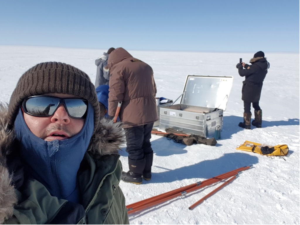
The objective of the mission was to retrieve multiple ice cores at the EGRIP site (75°37′N, 35°59′W, 2702 m a.s.l.) to study the natural as well as anthropogenic variation of tritium in the ice layers. We have studied the recent publications, which suggest lower snow accumulation rate than what we have previously thought. Therefore, we intended to drill more shallow cores. During five days at EGRIP (19-23 June 2023), we drilled five 24 m-long ice cores representing the last 100-110 years. The ice cores were cut into subsamples of 15 cm, and packed into plastic containers. One full core was collected. The bottom part (depth between 16.2 and 24.0 m) of the additional 4 cores was also collected to get more material for sensitive analysis of tritium by the 3He-ingrowth method.  Altogether 368 samples have been collected. Besides the cosmogenic tritium, stable isotopes of water, and Sr-Nd-Hf isotope signatures will be also analysed. To compare this latter to older ice (>10,000 years), we took ice samples at the ice margin in a location between the glaciers Isunnguata Sermia and Russell about 36 km from Kangerlussuaq, near Point 660. The ice there is supposed to be around 40,000 years old. We drilled a shallow core (~ 4 m), cut into 10 pieces, and stored in pre-cleaned plastic vessels. All of the ice samples have been already shipped to our laboratory in Hungary. The first analyses for stable isotopes, 137Cs around the Chernobyl event, and tritium around the bomb-peak have been already started.

Drilling down to 24 m in the clean area of the EGRIP site, Kangerlussuaq,
Drilling down to 24 m in the clean area of the EGRIP site, Kangerlussuaq, Greenland. Credit: László Palcsu.

Read full scientific report with kind permission by László Palcsu.


Back to TA main page.

Back to Europlanet 2024 RI homepage.

22-EPN3-126: In-Situ observations in support for VERITAS Venus analogue airborne radar campaign at Holuhraun and Djyngasandur, Iceland

22-EPN3-126: In-Situ observations in support for VERITAS Venus analogue airborne radar campaign at Holuhraun and Djyngasandur, Iceland

Solmaz Adeli and Stephen Patrick Garland (German Aerospace Center (DLR), Germany) to TA1 – Iceland Field Sites, MATIS
Dates of visit: 1-14 August 2023

The composition of lava fields on Venus and their alteration state is poorly understood. The Venus Emissivity Mapper (VEM)/VERITAS will observe the surface of Venus in the NIR range, which will allow studying the spectral characteristics of the Venusian surface, as well as the type of lava and likely alteration processes. To prepare for this mission, VERITAS organised a field campaign in Iceland in early August, 2023, which included in-situ NIR data acquisition by the DLR-Berlin team, enabled through this Europlanet funding. The main goals have been 1) to understand the in-situ NIR reflectance spectral response of Venus analogue material, 2) to acquire in-situ emittance of an active volcano in the NIR spectral range, 3) to collect samples to be analysed in the Planetary Spectroscopy Laboratory (PSL-DLR-Berlin) using reflectance and emittance spectroscopy methods, to create an emissivity spectral library, and 4) to compare the laboratory data with field measurements.

In order to collect a wide range of textures (from pahoehoe to a’a) and compositional variations of basaltic lava fields, in addition to different fumarolic deposits, the team visited and imaged the Holuhraun lava field, Askja lava field, and Fagradalsfjall area. These sites offer an age range from the altered 1960 Askja lava field to the 2023 eruption in Fagradalsfjall. The Askja and Holuhraun sites also offered variation in grain sizes and tefra and sand coverage, which affects the spectral behavior of the surface material in NIR. the team also collected about 60 kg of samples to be analysed in the Venus chamber of the PSL-DLR-Berlin.

Photos from the campaign can be found in the DLR Flickr Album: VERITAS – Expedition for NASA & ESA Missions to Venus:

VERITAS

22-EPN3-129: In-situ and laboratory spectroscopic characterisation of Icelandic lava flows

22-EPN3-129: In-situ and laboratory spectroscopic characterisation of Icelandic lava flows; an analogue of Venus – VERITAS mission preparation

Nils Mueller and Akin Domac (German Aerospace Center (DLR), Germany) to TA1 – Iceland Field Sites, MATIS
Dates of visit: 1-7 August 2023

As part of collaborative field work of the VERITAS science team, Nils Mueller and Akin Domac visited several locations with partially sediment covered lava flows in the vicinity of Askja, Vatnajokull National Park, Iceland. This was done simultaneously with an airborne radar campaign by the German Aerospace Center {DLR. e.V.) acquiring synthetic aperture radar images at X- and S-band, the wavelengths of the radar instruments on the Venus orbiters VERITAS and Magellan, respectively. The objective of the field­work was to document the nature and extend of sediment cover on lava flows and how it affects scattering and roughness at radar wavelengths. This will improve the combined Magellan/VERITAS SAR image interpretation by providing in-situ data that can be tied to specific S and X band backscatter values. Another aspect is change detection as the same airborne radar collected data of the near pristine Holuhraun lava flow in 2015.

The field work data collected includes photos, notes, LIDAR scans of SxS m2 patches, and clast and sediment samples from the the surface and, if possible, from 20 cm depth. The initial observations show that parts of the Holuhraun lava flow have been significantly modified by aeolian sediments in the 8 years since the end of the eruption. These sediments affect the roughness on radar wavelengths but also radar backscatter via changes in composition, density, clast size, and water content. Whether the changes are notable in the radar images remains to be seen, as the interpretation is ongoing.

Photos from the campaign can be found in the DLR Flickr Album: VERITAS – Expedition for NASA & ESA Missions to Venus:

VERITAS

20-EPN2-071: Deposition of organic matter as a factor controlling microbial colonisation of analogue terrestrial surfaces

20-EPN2-071: Deposition of organic matter as a factor controlling microbial colonisation of analogue terrestrial surfaces

Tina Santl-Temkiv (Aarhus University, Denmark) to TA1 – Iceland Field Sites, MATIS
Dates of visit: 29-30 June 2023

This project was designed to improve the understanding of biosignatures in analogue terrestrial surfaces, volcanic rocks, that result as a consequence of microbial colonisation and weathering. During the visit, the automatic medium-volume sampling system PNS DM — modified to run on batteries charged with solar panels — was assembled, tested, and calibrated in the laboratory of Matis.

Due to a delay in shipment of the solar panels, the installation of the system at the field site could not be performed but will be finalised by the host institution in the near future. As a part of the visit, the area of the Fagradalsfjall volcano was visited and the location where the sampling system will be installed was discussed. Once the sampler system will be installed in proximity of the Fagradalsfjall volcano crater, aerosol samples will be collected continuously for a year along with replicate rock samples in order to investigate the impact of aerosol deposition on rock microbial community assembly, using microbial, chemical and physical analysis. This will be performed in collaboration between the team of Prof. Viggó Þór Marteinsson and the team of Assoc. Prof. Tina Santl-Temkiv and will result in greatly improved understanding of colonisation, community assembly, and biosignature emergence in analogue terrestrial surfaces.

Read the full scientific report with kind permission by Tina Santl-Temkiv.

Banner image: Iceland’s Fagradalsfjall volcano. Credit: CC BY-SA 4.0 Mokslo Sriuba


22-EPN3-007: SeisChem – The influence of seismic events on fluid and gas chemistry at the Icelandic planetary field site

22-EPN3-007: SeisChem – The influence of seismic events on fluid and gas chemistry at the Icelandic planetary field site

Visit by John Edgar and Jon Telling (Newcastle University, UK) to TA1 – Iceland Field Sites, MATIS
Dates of visit: 12-21 September 2023

Measurable H2 can be generated during active seismicity through the reaction of water with freshly created rock surfaces. Field measurements have shown that rock-water reactions during seismic events can also lead to significant changes in the pH and increase the concentration of H2O2 in geological fluids. Whilst prior studies have investigated locations representing felsic crust, a large proportion of the deep biosphere resides in basaltic terrains. H2O2 generated through rock-water reactions is greater in basaltic rocks and enhanced when temperatures exceed ~80 °C. Importantly, these elevated temperatures overlap the growth ranges of some hyperthermophilic microorganisms. The generation of H2O2 in these environments represents an understudied energetic window of opportunity for extant microbial life, and possibly for the origins of life on Earth.

This project sampled a seismically active hydrothermal area in Iceland where elevated temperatures were anticipated to lead to enhanced H2O2 generation from rock-water reactions.
The SeisChem team investigated the relationship between seismicity and the products of rock – water reactions in a geologically active hydrothermal system. The central objective of SeisChem was to bridge a knowledge gap between laboratory studies and field measurements by:

  • Sample fluid and gas in time series, recording in-situ H2O2 and ancillary geochemical data
  • Store and return samples to the laboratory for H2 (g) and major ion (aq) analyses
  • Compare and contrast field and laboratory data with local seismic activity.

Read the full scientific report with kind permission by John Edgar and Jon Telling.


22-EPN3-130: Biosignatures in Icelandic geothermal aerosols

22-EPN3-130: Biosignatures in Icelandic geothermal aerosols

Visit by Mark Fox-Powell and Ben Stephens (Open University, UK) to TA1 – Iceland Field Sites, MATIS
Dates of visit: 23-31 August 2023

The aim of our project was to capture and study microscopic aerosols ejected from bubbling geothermal springs in Iceland, as an analogue for the formation of cryovolcanic plumes at icy moons such as Enceladus. This project built on a successful Europlanet-funded field campaign in 2022. Our objectives in 2023 were to (i) comprehensively map size-dependent aerosol fluxes with increasing distance and elevation from the springs; and (ii) to collect simultaneous samples for microbiological and elemental analyses at multiple downwind locations.

We focused our investigations on Olkelduhals hot springs, near Hverageroi, where a pool with circum-neutral pH supporting thick microbial streamers experiences constant moderate gas flux. Our data from 2022 showed that this spring is a prolific and constant source of aerosols. We found that downwind aerosol size distributions changed with distance and with elevation from the spring. Four complete aerosol sample sets were taken downwind of the spring; each requiring a full field day. A background (upwind) air sample was also taken. Comprehensive samples for geochemical and microbiological analyses were taken from the spring, along with the collection of volatile and semi-volatile organic compounds using thermal desorption tubes. The sample set will form the basis of a new PhD studentship, beginning in October 2023 at the Open University, which will investigate the chemical composition, biomass content and microbial diversity of aerosols, and the volatile profiles of geothermal gases. Our data will provide the first insights from natural analogues into the formation of aerosols within cryovolcanic plumes.


22-EPN3-116: Fault Scaling at Southwest Iceland

22-EPN3-116: Fault Scaling at Southwest Iceland

Visit by Işık Su Yazıcı (German Aerospace Center DLR, Germany) and Sebastian Sturm (University of Freiburg, Germany) to TA1 – Iceland Field Sites, MATIS
Dates of visit: 02-10 August 2023

Fault population studies reveal the lithospheric stress and strength conditions. Geometric fault properties provide insights into mechanical and temporal evolution of fault systems, as well as past and future potential for seismic energy release. Understanding the displacement-length relationship of faults can also help to estimate the current seismicity level. Improved constraints on the current seismicity of Mars based on lnSight mission results, are the motivation for a renewed and detailed analysis of martian fault systems. Partly due to the limited number of reliable datasets, data on the relationships between fault displacement and length of extraterrestrial bodies are scarce. Using Digital Elevation Models (OEM) and corresponding orthoimages derived from High Resolution Stereo Camera (HRSC) data, we previously obtained information on the displacement distribution along faults and the maximum displacement (Dmax) at the Memnonia Fossae (MF) fault system on Mars.

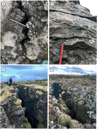
The volcanic rifting zone in SW Iceland displays similar characteristics as MF. Specifically, the availability of airborne HRSC data (HRSC-AX) of an area characterized by widespread normal faults in the rift zone at Thingvellir, and well-exposed faults in Reykjanes, are exceptionally well-suited sites as analogues for the MF. Considering the scarcity of terrestrial analogue work complementing the analysis of planetary fault scaling, this field work helps to improve our understanding of fault scaling relationships: Our goal is to combine terrestrial remote sensing data (HRSC-AX) with ground truth to obtain a better basis for evaluating planetary fault scaling (which relies on remote sensing only).

Read the full scientific report with kind permission by Işık Su Yazıcı.

Examples of faults in SW Iceland.
Examples of faults in SW Iceland. Credit: Işık Su Yazıcı.

22-EPN3-061: Analogue Studies to Test the Scientific Potential of the First SERS Prototype Analysis

22-EPN3-061: Analogue Studies to Test the Scientific Potential of the First SERS Prototype Analysis

Marco Veneranda and Guillermo Lopez-Reyes (University of Valladolid, Spain) to TA1 – Iceland Field Sites, MATIS
Dates of visit: 24-30 July 2023

Iceland provides access to a great variety of environments that are widely considered potential analogues of hydrothermal processes on Mars). Previous investigation revealed a wide variety of microbial communities proliferating at the water side of Krysuvik and Hveradalir hydrothermal systems. Although providing crucial information on the dynamics of extremophilic life, the lack of low altered mineralogical samples prevented from: 1) fully comprehend the hydrothermal weathering dynamics of the primary rock (extrusive Fe-rich basaltic lava), and 2) determine the relation between microbial proliferation and the degree of hydrothermal alteration of the hosting mineral substrate. 

As these two aspects are of key importance to understand the habitability potential of the ancient hydrothermal systems found on Mars, Marco Veneranda and Guillermo Lopez Reyes performed a new campaign of analysis to address these two topics. On one hand, the two researchers investigated the mineralogical composition of the two analogue sites by using a portable emulator of the RLS Raman spectrometer onboard the ESA/ExoMars rover. Afterwards, a novel device for the automated synthesis of SERS nanoemulsions was used to investigate the organic content of the hydrothermal waters. The obtained results were then used to select optimal geological and biological samples to be returned in the laboratory for further investigation. As a whole, this research project aims at supporting the RLS team in defining and optimizing the potential scientific outcome of the RLS instrument once it will be operated on the surface of Mars.

Read the full scientific report with kind permission by Marco Veneranda and Guillermo Lopez-Reyes.

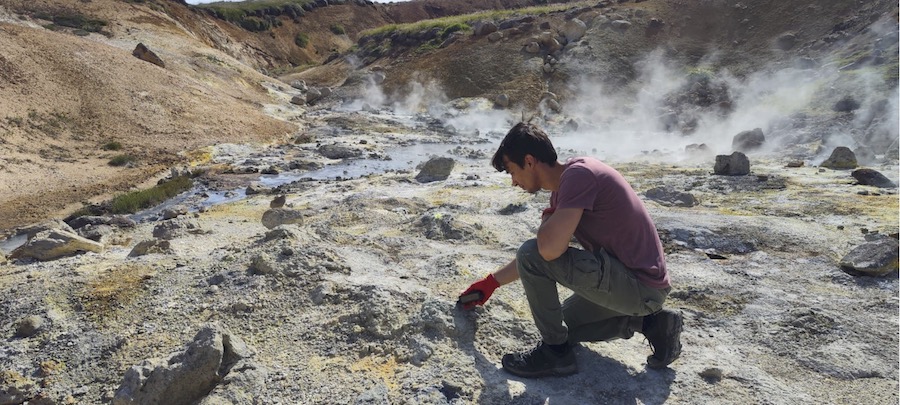
Molecular analysis performed in-situ by using a portable Raman spectrometer at the hydrothermal areas of Krýsuvik and Hveradalir.
Molecular analysis performed in-situ by using a portable Raman spectrometer at the hydrothermal areas of Krýsuvik and Hveradalir. Credit: M Veneranda.

22-EPN3-011: Phototrophic Microorganisms in Cold Deserts of Iceland

22-EPN3-011: Phototrophic Microorganisms in Cold Deserts of Iceland – Ecology and Diversity of Potential Analogues

Visit by Daniel Remias (University of Salzburg, Austria) and Lenka Procházková (Charles University, Czech Republic) to TA1 – Iceland Field Sites, MATIS
Dates of visit: 07-13 July 2023

Geology and climate of inland regions at Iceland are ideal prerequisites for exploring microbial adaptation to cold and dry habitats. Bare terrestrial ground surfaces and high­altitude melting snowfields represent niches at the edge of life on Earth. Soil samples were harvested at altitudes from almost at sea level up to more than 1000 m. Additionally, red snow caused by cryoflora (snow algae) from permanent snow packs in the Kerlingarfjoll Mountains were collected, and photosynthetic uptake rates were measured in situ with labelled carbon (13C). Red snow was transported to the lab and the pigments extracted and the UV-protecting pigments characterized by HPLC.

The main aim of the project was the molecular characterisation of the phototrophic microbial community for evaluation of abundance and diversity of terrestrial and frozen habitats. Barren, desert­like sites were compared with vegetated ones. Microalgae marker DNA were extracted with dedicated kits for environmental soil samples.

This study aims to shed light on how photoautotrophic microbial life could work at Earth analogues with similar or even worse climatical or soil conditions. Finally, Icelandic terrestrial microalgae will be tested as potential analogues compared to other worlds like Mars or icy moons.

Read the full scientific report with kind permission by Daniel Remias and Lenka Procházková.

Image credit: Desert-like sampling site close to Sandfell Mt. Credit: D Remias.


22-EPN3-087: Evolution and Icy Satellite Deformation through the Investigation of Glacial Environments and the Characterisation of Earth Analogues

22-EPN3-087: EVIDENCE – EVolution and Icy satellite Deformation through the investigation of glacial ENvironments and the Characterisation of Earth Analogues

Visit by Costanza Rossi (INAF-Astronomical Observatory of Padova, Italy) and Riccardo Pozzobon (University of Padova) to TA1.6 Argentinian Andes (Argentina).
Dates of visit: 20 February – 01 March 2024

Report Summary: The Tierra del Fuego glaciers in Patagonia (Argentina) represent optimal analogues for the study of the deformation of icy planetary surfaces, and in particular those of Jupiter and Saturn icy satellites. The multi-scalar approach of the EVIDENCE project addresses to the relation of the glacier’s deformation structures from local-scale to regional-scale. Such investigation provides pivotal support for planetary analysis, to better understand the expected local-scale structural pattern. Through the fieldwork in the Tierra del Fuego glaciers, scaling laws of deformation in icy surfaces have been identified from the tectonic setting at local-scale at both surface and depth.

The fieldwork in the Ushuaia area has allowed the identification of structures (fractures/faults) in Vinciguerra, Martial, Ojo del Albino and Alvear glaciers and in the Cueva del Jimbo. Field data have been acquired by UAV detection and structural geology survey and integrated in virtual outcrop models. Both high-angle extensional and strike structures and low-angle thrusts have been recognised at local-scale. Such data will be then compared with the structures visible on regional-scale satellite images of the investigated glaciers. This comparison will allow to understand analogies and differences of the structural pattern between the investigation scales and to gain knowledge that will be in turn applied to the regional-scale data of analogue areas in the surfaces of the icy satellites. In addition, structural measurements in bedrock outcrops surrounding the glaciers have been performed to understand the relationship between the underlying bedrock tectonics and glacial deformation.


21-EPN-FT1-003: Biogeochemical tools to search for biosignatures in microbial carbonates from extreme environments

21-EPN-FT1-003: Biogeochemical tools to search for biosignatures in microbial carbonates from extreme environments

Visit by Sylvie Bruggmann, University of Lausanne (Switzerland) and Camila Areias, Vrije Universiteit Amsterdam (Netherlands), to TA1.6 Argentinian Andes (Argentina).
Dates of visit: 10-16 December 2022

Report Summary: Microorganisms evolved under extreme conditions as the first forms of life on Earth. In the geological record, signatures of these microbial communities can be preserved in the chemistry of sedimentary rocks as microbialites. The identification of their biogenicity, however, is often ambiguous, as biosignatures can be overprinted, and abiotic processes may form similar signatures. Microbialites forming under extreme conditions on the modern Earth can be used as analogues to better understand the formation of biosignatures, and to improve their identification in sedimentary rocks from Earth and Mars.

The TA1 Facility 6 in the Argentinian Andes provides an ideal environment where carbonaceous microbialites form under extreme conditions, such as cold temperatures, low precipitation and high UV radiation. To better resolve the ambiguity of biosignatures, we use a combined approach of organic and inorganic biogeochemical tools to examine sediment and water samples. The organic tool focuses on lipid biomarkers that can be attributed to specific biogenic sources, such as cyanobacteria. In addition, the inorganic tool utilises elemental concentration and isotope compositions of biologically relevant metals, such as Fe or Sr, which can record information of a biogenic or abiotic origin. The combination of these organic and inorganic tools can improve the identification of biosignatures and their credibility can be enhanced.