20-EPN-61: Life in extreme environments: Distribution and importance of far-red light driven photosynthesis to primary production in Martian-like environments
Visit by Dennis Nürnberg, Freie Universität Berlin, (Germany) and Daniel Canniffe, Liverpool University (UK) to TA1.5 Makgadikgadi Salt Pans (Botswana). Dates of visit: 10-19 February 2022
The aim of this project was to confirm the richness and abundance of chlorophyll f-containing cyanobacteria, and their ability to use low-energy light to perform oxygenic photosynthesis in Martian-like environments. This study was a follow-up to a 2019 sampling trip to the sabkhas of the Western Sahara (Morocco), for which we could show that chlorophyll f-cyanobacteria are highly abundant. Here we expanded this research by collecting samples from the hypersaline environments of the Sua and Ntwetwe Pans in Makgadikgadi (Botswana). Microbial mat and rock samples containing endolithic and hypolithic phototrophs were collected. Light microscopy on site confirmed the abundance of cyanobacteria of various morphologies in most collected samples. The microbial mat samples were especially rich in cyanobacteria, forming a 1-2 mm thick layer at various depths depending on the absorption properties of the top layer.
Preliminary analyses with high-performance liquid chromatography (HPLC) in combination with hyperspectral confocal fluorescence microscopy confirmed the presence of red-shifted chlorophylls in some of these samples but to less extent as observed in the sabkhas. Genomic DNA has been extracted and will be used for sequencing and phylogenetic analyses based on 16S rRNA and specific far-red light genes. This will allow to fully evaluate the microbial diversity and their ability to perform chlorophyll f-driven oxygenic photosynthesis. In addition, the enrichment and isolation process of new chlorophyll f-containing cyanobacteria has been started by transferring the samples to growth media of various salinity and keeping them under selective far-red light illumination.
Report Summary:
Read full report, published with kind permission by Dr Nürnberg and Dr Canniffe.
21-EPN-FT1-026: Biogeochemical cycling in the lake systems of the Argentinian Puna: Biogeochemical cycling in the lake systems of the Argentinian Puna: An investigation into the microbial communities of an exceptional Hesperian martian analogue
Report Summary: Fieldwork undertaken as part of the Europlanet fast track funding call took place between 16/04/22 and 26/04/22 as part of an international team of scientists from The Open University, The Università degli Studi della Tuscia, and The Universidad Nacional de Córdoba.
Fieldwork was conducted at two high-altitude Andean Lake (HAAL) sites, Laguna Negra, and Laguna de Antofagasta. The focus of the research was to collect sediment cores and water samples from Laguna de Antofagasta to assess how microbial communities change as a factor of depth within the sediment. During the trip, a total of 5 x 30 cm cores, 5 x 250 ml of lake water for culturing, and 15 x lake water samples for geochemical analysis were collected. Furthermore, environmental variables were taken with pH, temperature, conductivity, redox potential, and UV monitored. The trip was a resounding success with enough samples taken to permit the progression of my PhD. The data gained from the trip will contribute to two or three data chapters. These chapters will focus on the geochemical characterisation of the site, the microbiology of the site, and potentially simulation experiments which will focus on Noachian/Hesperian Mars relevant metabolisms. We expect to find that LDA is a suitable geochemical analogue for Gale Crater during the Noachian Hesperian transition. We also expect that the types of metabolisms found within the sediments are similar to those predicted to have been present on Noachian/Hesperian Mars.
20-EPN2-020: Towards prospecting ore deposits on Mars: remote sensing of the planetary field analogue in the Rio Tinto mining area, Spain.
Visit by Jakub Ciazela and Dariusz Marciniak, Institute of Geological Sciences, Polish Academy of Sciences (Poland) to TA1.2 Rio Tinto (Spain). Dates of visit: 17-27 March 2022
Report Summary: The Rio Tinto area hosts the largest known volcanogenic massive sulfide deposits on Earth. We have investigated 614 sites along a river bed (Fig. 1) located 3 m from each other. At each site, we investigated 5 random samples for pyrite content. The pyrite content was always estimated by 2 to 4 researchers, and the average for each site was computed. The average pyrite content in the entire investigated area is 7.0 vol.% (12.6 wt.%). We have observed two fields, 30 x 30 m, and 30 x 60 m, with average pyrite contents >50 wt.%, which should be suitable for its detection from the orbit, both with Sentinel-2 (field resolution of 10 m) and Landsat (30 m). Principle Component Analysis of the obtained spectra from Sentinel-2 (Fig. 2) gives similar results to mineralogical data we have retrieved in the field during our geological mapping.
By establishing our test field for remote sensing of sulfide deposits in a planetary field analog on Earth, we will be able to determine abundance thresholds for the detection of major sulfide phases on Mars and identify their key spectral features. Our results will help in 1) more efficient use of the current NIR Martian spectrometers to detect ore minerals and 2) designing new space instruments optimized for ore detection to include in future missions to Mars such as one developed at the Institute of Geological Sciences and the Space Research Centre of the Polish Academy of Sciences called MIRORES (Martian far-IR ORE Spectrometer).
20-EPN2-015: In-situ measurement and sampling of biosignature-hosting products in support of organics detection in the context of ExoMars/2022: In-situ measurement and sampling of biosignature-hosting products in support of organics detection in the context of ExoMars 2022
Visit by Marco Ferrari and Simone De Angelis, IAPS-INAF (Italy) to TA1.2 Rio Tinto (Spain). Dates of visit: 11-16 July 2022
Report Summary: This project aims at sampling and performing a wide set of VIS-NIR field measurements of weathering products (e.g., sulfates, clays), rocks with hydrothermal origin, and deposits showing evidence of biosignatures. To achieve this goal, during our visit we performed 195 measurement spots with the FieldSpec 4 portable spectrometer in the range of 0.35-2.5 µm and collected 47 samples in different forms. Among all the collected samples, three of them are consistent rock blocks. This is because they will be used as a test for the laboratory model of the Ma_MISS instrument that will be able to drill them and perform the spectroscopic measurements in the borehole wall.
This campaign will also allow us to confirm the capability of the Ma_MISS instrument to detect spectral signatures of organics in geological samples containing bi_osignatures. With the spectroscopic data obtained in the field and the laboratory on the collected samples, we will build a spectral database that will be useful to the scientific community.
These activities on terrestrial analogs have proven useful for understanding life in extreme conditions and how these can be preserved in the form of biological signatures and detected by the scientific instruments that will be on board future missions to Mars.
In addition, this work helps in acquiring crucial preparation for the exploitation and interpretation of the scientific data that the Ma_MISS instrument will provide during the active phase of the mission.
Looking for clues about water circulation on Mars in the remote Makgadikgadi salt pans of Botswana
From 18 – 28 October 2021, researchers Erica Luzzi, Jacobs University (Germany) and Gene Schmidt, Università degli Studi Roma Tre (Italy) were funded by the Europlanet 2024 Research Infrastructure (RI) Transnational Access (TA) programme to visit the Makgadikgadi Salt Pans in Botsawana. The trip was led by Fulvio Franchi (Botswana International University of Science and Technology (BIUST)) who is responsible for the Botswana Planetary Field Analogue for Europlanet 2024 RI. In this guest post, Erica Luzzi reports on the field trip.
Our trip to Botswana through the Transnational Access offered by Europlanet has given us an incredible amount of surprises.
Figure 1: View of the Makgadikgadi Salt Pans. Credit: E Luzzi
In addition to the precious data that we collected, we indeed had a life-changing experience visiting one of the most remote places on Earth. From the absolute silence in the desert, to the calm and breath-taking landscapes in the savanna, for some moments we really felt like being on another planet. Among many adventures (and misadventures), we accessed this extraordinary place on Earth, where a lot has been studied but still leaving space for many mysteries: the Makgadikgadi salt pans (Fig. 1). These dry lands occupy a broad area in the savanna of Botswana, and are characterized by a mixture of clays and sulfates with recurrent morphologies related to desiccation processes, such as mud cracks (Fig. 2).
Mud cracks in the pan, formed by dessication processes typical of playa environments. Credit: E Luzzi
This area once hosted an ancient lake which, due to paucity of water, turned into a playa, namely a dry lake bed. Such dry environments are hypothesized to have occurred also on Mars, where also the same types of minerals have been detected.
Part of a line in the pan. The deployed cable followed the truck’s footprints that were guided by the GPS. Credit: E Luzzi.
By studying an analog field site that we can touch with our hands as it is located on Earth, we can get a variety of insights that may help us to better investigate the processes that shaped Mars into the planet we observe today.
In the region of Arabia Terra, on Mars, light-toned layered deposits often associated with mounds have been widely described in literature, and among other interpretations they were also attributed to playa-like environments. The aim of our work was to analyse the subsurface of the Makgadikgadi salt pans, looking for faults where water could have circulated and then contributed to the hydro-geological cycle that led to the deposition of such deposits.
We performed an Electrical Resistivity Tomography survey in different areas of the pans (Fig. 3).
This particular type of geophysical technique consists of placing a number of electrodes in the ground, carefully spacing them at an equal distance, and then applying a known current. Each material responds to the current in a different way, and many variables can influence the resistivity (e.g. porosity, water content, mineralogy, etc.). A preliminary version of the resulting images confirmed the occurrence of faults that will be better investigated after a robust post-processing of the data.
While we are still working on it, for now we can conclude that the survey has been successful and we look forward to linking our observations with the enigmatic deposits occurring in Arabia Terra, Mars.
Read more about Erica’s experiences on this thread on Twitter:
4) The team. Our group was composed by Gene Schmidt, first author of the future paper, Fulvio Franchi, prof at BIUST, Ame Thato Selepeng, prof at BIUST, Cabelo, an MSc student at BIUST, Rachel, driver at BIUST, and me. I thank them all for this extraordinary experience. 5/ pic.twitter.com/pabwcH8eC1
20-EPN2-121: Constraining the movement of groundwater and fluid expulsion within playa environments on Mars
Visit by Gene Schmidt, Università degli Studi Roma Tre (Italy) and Erica Luzzi, Jacobs University (Germany) to TA1.5 Makgadikgadi Salt Pans (Botswana). Dates of visit: 20-27 October 2021
Across the surface of Mars there is evidence of past lacustrine and evaporitic environments found within basins and craters, where often layered sedimentary deposits and hydrated minerals are observed. However, the intensity, duration and precise phases of water cycle activity during this period remain unresolved. Although several geological processes and locations on Earth have been previously proposed as examples to describe these deposits on Mars, we lack a strong visualisation of what water activity might have looked like during evaportic stages within basins and craters. The Makgadikgadi Salt Pans of Botswana, where once the Makgadikgadi Lake existed, is a present evaporitic environment rich in hydrated minerals and water activity. It is a depression located at the southwestern end of a northeast-southwest set of graben. Faults have been previously proposed to have been pathways for groundwater to enter basins and craters on Mars, which then contributed to both the deposition and alteration of the sedimentary deposits. Thus, imaging the subsurface of a similar environment on Earth can help us to better understand how water processes on Mars might have continued as the Martian global climate became drier.
By using the already established locations of the faults to the north of the pans, we used remote sensing techniques to trace the best location of the faults underneath the pans (Figures 1 and 2). We then used electrical resistivity surveys to image 70 – 150 m of the pans’ subsurface where the faults were deemed most likely to occur. This work allows us to better understand the possibilities of what the underlying lithology of rocks within filled basins and craters might look like. Furthermore, it demonstrates the scientific importance of future missions to employ subsurface imaging techniques on Mars.
From 29 September – 6 October 2021, researchers Daniel Toledo and Victor Apestigue (Instituto Nacional de Técnica Aeroespacial (INTA), Spain) were funded by the Europlanet 2024 Research Infrastructure (RI) Transnational Access (TA) programme to visit the Makgadikgadi Salt Pans in Botsawana. The trip was led by Fulvio Franchi (Botswana International University of Science and Technology (BIUST)) who is responsible for the Botswana Planetary Field Analogue for Europlanet 2024 RI. Ignacio Arruego, Javier Martinez-Oter and Felipe Serrano (INTA) also participated in the field trip.In this guest post, Daniel Toledo reports on the field trip.
The main goal of the field campaign in the Makgadikgadi Salts Pans was to study how dust is lifted into the air. For our investigation, we used the spare units of the Radiation and Dust Sensor (RDS) from the NASA Mars 2020 mission and the Sun Irradiance Sensor (SIS) from the ExoMars 2022 mission (see Figure 1), which are designed to study dust carried in the atmosphere of Mars by measuring how sunlight is scattered by the dust particles.
In addition to giving information about the properties of airbourne dust, these instruments are also sensitive to the presence of dust devils – swirling columns of sand and dust that are a common feature of desert areas on Mars and on Earth. RDS and SIS can detect the changes over time in the sky brightness produced by a dust devil, and this offers a unique opportunity for monitoring and studying such events during the Mars 2020 and ExoMars 2022 missions. However, to be able to characterise and interpret dust devil observations on Mars, we first need to understand how dust devils affect SIS and RDS signals by thorough testing and evaluation of the instruments in Mars-like conditions on Earth.
Figure 1. (Left) RDS instrument: two sets of eight photodiodes. One set is pointed upward, with each photodiode covering a different wavelength range between 250-1000 nanometres. The other set is pointed sideways, 20° above the horizon, and they are spaced 45° degrees apart in azimuth to sample all directions at a single wavelength; a zenith-pointed camera (Skycam) with special optics is designed to measure column optical depth.(Right) SIS instrument: Five detectors pointed at zenith and with different spectral bands and Fields of View (FOVs); twelve lateral detectors (six in the ultraviolet range and six in the near infrared range) pointed sideways; a micro-spectrometer pointed directly upwards (at zenith) with a spectral resolution of 10 nanometres in the 340-780 nanometres range.
Figure 2. Dust devils observed in Makgadikgadi Salt Pans (left panel) and on Mars (right panel). A typical dust devil on Mars spans from hundreds of metres to thousands of metres in diameter, with a height one-eight times as large. Dust devils of Mars are thought to account for the ~50% of the total dust budget, and they represent continuous source of lifted dust, active even outside the dust storms season. For these reasons, they have been proposed as the main mechanism able to sustain the constantly-observed dust haze in the martian atmosphere.
To achieve this goal, we planned a field campaign from 29 September to 6 October in the southern part of Makgadikgadi Salt Pans (see Figure 3), in the Pan near Mopipi town. This location is characterised by frequent dust devil events and conditions that promote the lifting of high levels of aerosols (dust and particles) into the atmosphere.
Each day of the campaign, we set up RDS and SIS at two different locations from sunrise to sunset, separated by about 25 m, along with:
Two cameras to record panoramic videos during the campaign period.
A Vaisala weather station to perform measurements of pressure, wind direction and intensity, temperature and relative humidity.
A ZEN radiometer to measure how much light was absorbed by the dust at different wavelengths.
The objective of having the two main instruments at two different locations was observe the dust lifting events from different perspectives.
During the campaign, we observed a large number of dust devils (many more than 10) and dust lifting events produced by wind gusts (over 10). For each dust lifting, we recorded the dust devil distance, the size, duration and direction. To do this, we marked out concentric circles with radii of 25, 50, 75, 100, 125 and 150 m on the ground. This information along with the videos made by the cameras, helped us to establish the amount of dust lifted by the dust devil as well as their distances from the instruments. All the data collected for each event was key to establish the RDS and SIS capabilities for dust lifting characterisation on Mars.
The first two days of the campaign were characterised by high dust-loading conditions and frequent formations of dust lifting events produced by dust devils or wind gusts. During these two days, each dust lifting event registered by the cameras was also detected by RDS and SIS, with signals showing a sharp peak at the time when the event passed within the sensors field of view. Preliminary analysis suggests that we can infer from RDS and SIS signals the difference between dust lifting events produced by dust devils and those produced by wind gusts – an important result for the observations on Mars.
Figure 3. Map indicating the location selected for carrying out the field campaign in the southern part of Makgadikgadi Salt Pans (red square) and the village Rakops (black square) where different lodges are available.
The third day of campaign had to be cancelled due to rain. This resulted in a lower dust-loading conditions in the following days, and thus the amount of dust lifted by vortices or wind gusts was smaller compared to the first two days.
Upon return to BIUST in Palapye on 6 October, we held a seminar for staff and students titled Atmospheric science on Mars: from Earth analogues to future planetary networks.
In summary, the campaign was a complete success. Our observations have demonstrated the capability of the RDS and SIS sensors to detect and characterise dust devils on Mars. The analysis of the signals along with the information acquired by the other instruments will allow us to quantitatively establish the sensors limit of detection. In addition, the rainy episode offered us the chance to study dust lifting events in different aerosol loading conditions.
20-EPN2-046: Characterising dust lifting events using the ground-based Mars-2020-RDS and ExoMars-2022-SIS radiometers
Visit by Daniel Toledo, INTA (Spain) to TA1.5 AU Makgadikgadi Salt Pans (Botswana). Dates of visit: 29 September – 06 October 2021
Report Summary:
On Mars, the airborne dust is a critical factor that drives the weather and climate of the planet. Dust devils are thought to account for the ~50 % of the total dust budget, and they represent a continuous source of dust, present even outside the dust storms period. For these reasons they have been proposed as the main mechanism able to sustain the observed dust haze of the martian atmosphere. However, additional dust devil surveys covering long diurnal periods are needed to place quantitative constraints on the cycles of these events. In this regard, the present and future observations of the Radiation and Dust Sensor (RDS) and the Sun Irradiance Sensor (SIS), which are part of NASA Mars 2020 and ESA/Roscosmos ExoMars 2022 missions, offer a unique opportunity to monitoring dust devils at high temporal resolution from sunrise to sunset, and with an excellent spatial coverage.
The main goal of the field campaign in the Makgadikgadi Salts Pans (20-EPN2-065) was to study dust lifting events using the spare units of RDS and SIS. During the campaign (29 Sept to 6 Oct 2021), a large number of dust devils (>10) and dust lifting events produced by wind gusts (>10) were observed by RDS and SIS sensors. For each case, information on distance, size, temporal duration and direction was registered. This information along with observations made by other instruments (e.g. wind speed and direction), have allowed us to study the potential RDS and SIS capabilities for dust lifting characterisation on Mars.
20-EPN2-046: Investigating molecular and isotopic fingerprints of life on Greenland Ice Sheet (GrIS) cryo-ecosystems with astrobiological interest for icy worlds.
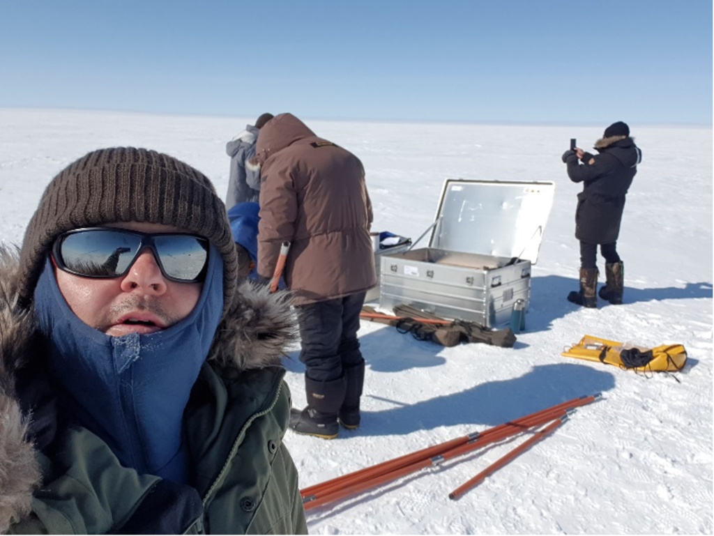
Visit by Laura Sánchez-García, Centro de Astrobiología (INTA-CSIC), Madrid, Spain, to TA1.4 AU Greenland Kangerlussuaq Field Site (Greenland). Dates of visit: 19-25 July 2021
Report Summary:
Glacial systems are interesting for studying habitability and limits of life. They are extreme environments where indigenous microorganisms may survive prolonged exposure to sub-zero temperatures and background radiation for geological timescales. Glaciers and the surrounding cryo-environments (permafrost, glacial lakes, or melting streams) arise as relevant scenarios for studying the development of functional microbial cryo-ecosystems and may have implications in the search for past or extant life in icy worlds beyond the Earth. In the Solar System, Europa and Enceladus have been recognized as the icy worlds with highest likelihood to harbor life, largely because liquid water could be in contact with rocks. Both satellites are believed to contain a global ocean of salty water under a rigid icy crust that would provide the scenario for an interaction between briny water and rocks, and the conditions for life to arise.
The permanent Greenland Ice Sheet (GrIS) represents a possible analog of such icy worlds, constituting an important long-term repository of psychrophilic microorganisms. Around the GrIS, different formations such as glacial lakes, permafrost, or further peat soils represent diverse degree of succession upon the influence of the GrIS and its thermal destabilisation.
We propose investigating molecular and isotopic lipid biomarkers of microorganisms inhabiting different cryo-ecosystems at and around the GrIS to obtain clues of a potential life development on analogous extraterrestrial cold environments (ice sheet), and learning how ecosystems evolves (biological succession) when the ice cover retreats and gets exposed to the atmosphere (glacier-melting streams, bedrock-erosion sediments, lake sediments, glacial soils).
Report Summary: The aim of this field campaign was to investigate the dynamics of aeolian mineral dust activity and organic carbon burial in western Greenland. Dust is an important component of the global climate system, and investigating its mobilisation, transport and deposition can reveal important information about regional climate and environmental development during the Holocene. Carbon burial in permafrost is one of the main mechanisms by which carbon is sequestered from the atmosphere, and may be linked to dust activity in high latitudes. The work focused on the area between the Greenland Ice Sheet margin and Kangerlussuaq, which represents a range of environmental conditions depending on distance from the ice sheet. We collected modern analogue samples of terrestrial windblown dust (loess) deposits to test and compare the performance of optically stimulated luminescence and radiocarbon dating. These samples were taken at a high-resolution from the surface of the deposits and thus represent recent aeolian activity. Furthermore, we targeted aeolian deposits containing palaeosol layers to be able to independently compare radiocarbon and luminescence ages, and to identify climate phases which were favourable for soil formation and carbon burial. In addition to purely aeolian sediments, peat bogs were also sampled.
These highly organic deposits complement the nearly purely minerogenic loess deposits because they effectively capture and preserve fine-grained wind-blown sediments. Further analysis of these samples and the use of different climate and carbon burial proxies will reveal important details of the regional climate history, dust-carbon burial dynamics, and provide insights into ice-proximal wind dynamics.
Report Summary: The Isunguata Sermia and Russell glaciers represent optimal analogues for the study of deformation in glacial environments and their comparison with deformation that affects the icy satellites of Jupiter and Saturn. The aim of UPSIDES project concerns the relation of tectonic structures from the outcrop to the regional scale with multi-scalar investigation which can provide significant support for planetary analysis. The collection of field data has been significant to find scaling laws between tectonic structures in glaciers and in icy satellite surfaces, and the behaviour at depth of their tectonic structures.
The successful fieldwork in the Kangerlussuaq area enabled the identification of tectonic structures in representative areas of the Isunguata Sermia (southern margin) and Russell glaciers (northern margin and terminus). More than 250 data have been collected from 31 field measurement stations including high dip- and low dip-structures, originated by different stress fields caused by the westward flow of both glaciers. We recognized high dip-extensional fractures approximately E-W and NE-SW trending at the Russell glacier. On the other hand, NNW-SSE trending fractures and low-angle faults, such as compressional thrusts/shear planes, have been detected at the Isunguata Sermia. From satellite imagery and aerial photos, we detected consistent structural orientations with the structures identified in outcrop. A similar correlation will be applied to the structures recognised by remote sensing on the icy satellites. Additionally, at the outcrop scale we identified structures acting as preferential way of fluid circulation. We performed measurements also in rock outcrops near the glacier to understand the relationship between bedrock morpho-tectonics and ice drainage that in turn control the measured glacial deformation.
20-EPN-017: LITRASV – Life in TRAvertine-Sinter Veins: a possible key to recognize extra-terrestrial life in tectonically-driven depositional systems.
Visit by Enrico Capezzuoli, University of Florence and Andrea Brogi, University of Bari (Italy) to TA1 – Iceland Field Sites, MATIS Dates of visit: 04-10 July 2021
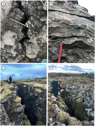
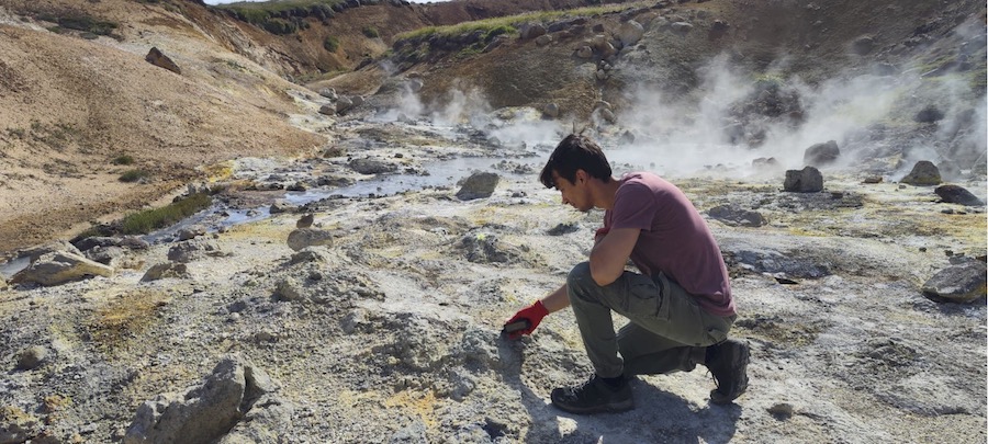
Report Summary: Detailed study of travertine and sinter depositional systems and related feeder conduits (veins) in cold desertic setting (Lýsuhóll and Hveravellir sites- Iceland), as possible repository of subsurface life to be observed in extra-terrestrial setting. The performed field activity allows reconstruction of the structural control in these sinter/travertine depositional systems, with stratigraphic-sedimentological characterisation of the travertine-sinter lithofacies. 16 travertine/sinter samples were collected from the two sites, together with the basic physical characterization of the thermal springs (T, pH, Cond). Due to the local conditions, all the collected samples derive from fossil/inactive systems (veins and crusts samples). Among these, one sample derives from a sinter vein recognized in the Lýsuhóll site, while all other derive from fossil vents or close surroundings.
Samples returned to Italy for future petrographic and geochemical characterization in order to detect and define possible organic presence in such an extreme environment.